State Parks in New Hampshire
Dies ist eine Liste der State Parks im US-Bundesstaat New Hampshire. Die Verwaltung erfolgt durch die New Hampshire Division of Parks and Recreation. New Hampshire verfügt über 93 State Parks und deren zugeordnete State Historic Sites und weitere staatliche Schutzgebiete. Im Jahr 1993 wurden White Island und einige andere Inseln der Gruppe in das System der New Hampshire State Parks überführt und werden nun vom Bureau of Historic Sites verwaltet.
State Parks
| Name[1][2] | County | Stadt | Koord. | Größe | Gegründet | Bild |
|---|---|---|---|---|---|---|
| Ahern State Park | Belknap | Laconia | Lage43.5555-71.4973 | 52 ha (128 Acres) | 1994 |  |
| Androscoggin Wayside Park | Coös | Errol | Lage44.741667-71.18 | 0,40 ha (1 Acre) | 1958 |  |
| Bear Brook State Park | Merrimack | Allenstown | Lage43.107-71.352 | 4080 ha (10.083 Acres) | 1943 |  |
| Beaver Brook Falls Wayside | Coös | Colebrook | Lage44.92004-71.4648 | 3,0 ha (7,3 Acres) |  | |
| Cardigan Mountain State Park | Grafton | Orange | Lage43.656-71.9103 | 2288 ha (5.655 Acres) | 1939 |  |
| Chesterfield Gorge Natural Area | Cheshire | Chesterfield | Lage42.9145-72.4045 | 5,3 ha (13 Acres) | 1948 | 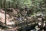 |
| Clough State Park | Hillsborough | Weare | Lage43.0967-71.657 | 1964 | 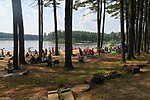 | |
| Coleman State Park | Coös | Stewartstown | Lage44.9381-71.3245 | 637 ha (1573 Acres) | 1956 |  |
| Crawford Notch State Park | Carroll | Hart’s Location | Lage44.178-71.4 | 2337 ha (5775 Acres) | 1913 |  |
| Deer Mountain Campground | Coös | Pittsburg | Lage45.1911-71.192 | |||
| Dixville Notch State Park | Coös | Dixville | Lage44.863889-71.293889 | 51 ha (127 Acres) | 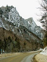 | |
| Echo Lake State Park | Carroll | Conway | Lage44.053-71.157 | 48 ha (118 Acres) |  | |
| Eisenhower Memorial Wayside Park | Coös | Crawford's Purchase | Lage44.239722-71.425278 | 2,8 ha (7 Acres) | 1979 | 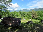 |
| Ellacoya State Park | Belknap | Gilford | Lage43.569444-71.354722 | 33 ha (82 Acres) | 1956 | 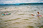 |
| Forest Lake State Park | Coös | Dalton | Lage44.3534-71.6759 | 161 ha (397 Acres) | 1935 | 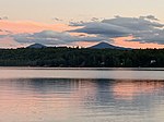 |
| Franconia Notch State Park | Grafton | Franconia | Lage44.149444-71.686667 | 2708,5 ha (6692,8 Acres) | 1928 |  |
| Gardner Memorial Wayside Park | Sullivan | Springfield | Lage43.4833-71.9752 | 1980 |  | |
| Greenfield State Park | Hillsborough | Greenfield | Lage42.95841-71.887 | 160 ha (400 Acres) |  | |
| Hampton Beach State Park | Rockingham | Hampton | Lage42.932-70.7981 | 20 ha (50 Acres) | 1933 |  |
| Jenness State Beach | Rockingham | Rye | Lage42.9856-70.7619 | 0,53 ha (1,3 Acres) | 1980 |  |
| Jericho Mountain State Park | Coös | Berlin | Lage44.496389-71.256389 | 3010 ha (7430 Acres) | 2005 | 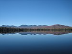 |
| Kingston State Park | Rockingham | Kingston | Lage42.929-71.055 | 18 ha (44 Acres) |  | |
| Lake Francis State Park | Coös | Pittsburg | Lage45.061-71.301 | 15 ha (38 Acres) | 1976 | |
| Lake Tarleton State Park | Grafton | Piermont | Lage43.9836-71.9758 | 19 ha (48 Acres) |  | |
| Madison Boulder Natural Area | Carroll | Madison | Lage43.93146-71.1678 | 6,9 ha (17 Acres) | 1946 |  |
| Milan Hill State Park | Coös | Milan | Lage44.572222-71.223056 | 41 ha (102 Acres) | 1939 | |
| Miller State Park | Hillsborough | Peterborough | Lage42.859444-71.883056 | 216 ha (533 Acres) | 1891 |  |
| Mollidgewock State Park | Coös | Errol | Lage44.7378-71.1439 | 19 ha (46 Acres) | 1972 |  |
| Monadnock State Park | Cheshire | Jaffrey | Lage42.8625-72.0675 | 412 ha (1017 Acres) |  | |
| Moose Brook State Park | Coös | Gorham | Lage44.407778-71.230556 | 306 ha (755 Acres) | 1936 |  |
| Mount Sunapee State Park | Merrimack | Newbury | Lage43.3211-72.0623 | 1171 ha (2893 Acres) | 1948 |  |
| Mount Washington State Park | Coös | Sargent's Purchase | Lage44.269419-71.301699 | 24,4 ha (60,3 Acres) | 1964 | 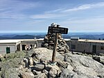 |
| Nansen Wayside Park | Coös | Milan | Lage44.533056-71.17 | 5,7 ha (14 Acres) |  | |
| North Hampton State Beach | Rockingham | North Hampton | Lage42.9537-70.7836 | 0,45 ha (1,1 Acres) | 1980 |  |
| Northwood Meadows State Park | Rockingham | Northwood | Lage43.2132-71.1981 | 273,0 ha (674,5 Acres) | 1990 | |
| Odiorne Point State Park | Rockingham | Rye | Lage43.043611-70.714444 | 135,0 ha (333,7 Acres) | 1961 | 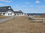 |
| Pawtuckaway State Park | Rockingham | Nottingham | Lage43.101944-71.181111 | 2240,4 ha (5536,1 Acres) | 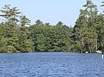 | |
| Pillsbury State Park | Sullivan | Washington | Lage43.230833-72.099722 | 1803 ha (4456 Acres) |  | |
| Pisgah State Park | Cheshire | Chesterfield | Lage42.840278-72.453611 | 5407 ha (13361 Acres) | 1967 | |
| Rhododendron State Park | Cheshire | Fitzwilliam | Lage42.784722-72.191111 | 1102 ha (2723 Acres) | 1947 | 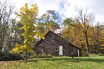 |
| Rollins State Park | Merrimack | Warner | Lage43.345833-71.849444 | 48,0 ha (118,5 Acres) | 1950 | 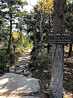 |
| Rye Harbor State Park | Rockingham | Rye | Lage43.0017-70.7446 | 25 ha (63 Acres) | 1936 |  |
| Sculptured Rocks Natural Area | Grafton | Groton | Lage43.707222-71.855556 | 110 ha (272 Acres) |  | |
| Silver Lake State Park | Hillsborough | Hollis | Lage42.7625-71.593333 | 32 ha (80 Acres) | 1954 |  |
| Umbagog Lake State Park | Coös | Errol | Lage44.7023-71.0555 | 55,0 ha (136,0 Acres) | 1998 |  |
| Wadleigh State Park | Merrimack | Sutton | Lage43.3572-71.9453 | 17 ha (43 Acres) | 1934 | |
| Wallis Sands State Beach | Rockingham | Rye | Lage43.027778-70.728889 | 12 ha (30 Acres) | 1964 |  |
| Weeks State Park | Coös | Lancaster | Lage44.450278-71.570556 | 170 ha (420 Acres) | 1941 |  |
| Wellington State Park | Grafton | Alexandria | Lage43.641-71.7789 | 83 ha (204 Acres) | 1931 |  |
| Wentworth State Park | Carroll | Wolfeboro | Lage43.6131-71.1478 | 20 ha (50 Acres) | 1934 | |
| White Lake State Park | Carroll | Tamworth | Lage43.8409-71.2222 | 365,3 ha (902,7 Acres) | 1933 | |
| Winslow State Park | Merrimack | Wilmot | Lage43.3901-71.8679 | 1935 | 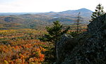 |
State Historic Sites
| Name[3] | County | Stadt | Koord. | Größe | Gegründet | Bild |
|---|---|---|---|---|---|---|
| Bedell Bridge State Historic Site | Grafton | Haverhill | Lage44.045-72.073 | 15 ha (38 Acres) | 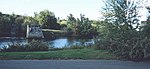 | |
| Daniel Webster Birthplace State Historic Site | Merrimack | Franklin | Lage43.4145-71.697 | 59 ha (147 Acres) |  | |
| Endicott Rock State Historic Site | Belknap | Laconia | Lage43.604167-71.456111 | 0,040 ha (0,1 Acres) |  | |
| Fort Constitution State Historic Site | Rockingham | New Castle | Lage43.071319-70.710206 | 0,81 ha (2 Acres) |  | |
| Fort Stark State Historic Site | Rockingham | New Castle | Lage43.0575-70.712778 | 4,0 ha (10 Acres) |  | |
| Franklin Pierce Homestead State Historic Site | Hillsborough | Hillsborough | Lage43.116389-71.950556 | 5,3 ha (13 Acres) |  | |
| Governor Wentworth Historic Site | Carroll | Wolfeboro | Lage43.6006-71.1236 | 39 ha (96 Acres) |  | |
| Hannah Duston Memorial State Historic Site | Merrimack | Boscawen | Lage43.288163-71.590713 |  | ||
| John Wingate Weeks Historic Site | Coös | Lancaster | Lage44.450278-71.570556 | 170 ha (420 Acres) | 1941 |  |
| Nansen Ski Jump State Historic Site | Coös | Milan | Lage44.533056-71.17 | 5,7 ha (14 Acres) |  | |
| Robert Frost Farm State Historic Site | Rockingham | Derry | Lage42.871667-71.295 |  | ||
| Taylor Mill State Historic Site | Rockingham | Derry | Lage42.875603-71.239217 |  | ||
| Tip-Top House | Coös | Sargent's Purchase | Lage44.270556-71.303889 |  | ||
| Wentworth–Coolidge Mansion State Historic Site | Rockingham | Portsmouth | Lage43.061667-70.738889 | 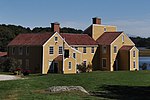 | ||
| White Island State Historic Site | Rockingham | Rye | Lage42.9673-70.6232 | 2,0 ha (5 Acres) |  | |
| Willey House | Carroll | Hart's Location | Lage44.182222-71.399444 |  |
Andere staatliche Schutzgebiete
Andere bemerkenswerte Gebiete, die sich noch im Besitz des Staates befinden, aber nicht gepflegt werden.
| Name[2] | County | Stadt | Koord. | Größe | Gegründet | Bild |
|---|---|---|---|---|---|---|
| Bear's Den Natural Area | Cheshire | Gilsum | 38 ha (95 Acres)[4][5] | |||
| Binney Pond Natural Area | Hillsborough | New Ipswich | 40 ha (99 Acres)[6] | |||
| Bradford Pines Natural Area | Merrimack | Bradford | 2,0 ha (5 Acres)[7] | |||
| Crosby Mountain State Park | Grafton | Groton | 35 ha (86 Acres)[8] | Gestiftet 1971 | ||
| Curtiss Dogwood Natural Area | Hillsborough | Wilton | 5,7 ha (14 Acres) | |||
| Dublin Lake Scenic Area | Cheshire | Dublin | 0,53 ha (1,3 Acres) |  | ||
| Heath Pond Bog Natural Area | Carroll | Ossipee | 557,9 ha (1378,5 Acres)[9][10] | |||
| Humphrey's Ledge Natural Area | Carroll | Bartlett | 15 ha (36 Acres)[11] | |||
| Jeremy Mill Natural Area | Hillsborough | Pelham | 25 ha (63 Acres)[12][13] | |||
| Mascot Mine Natural Area | Coös | Gorham | 4,7 ha (11,7 Acres)[14] | |||
| Ossipee Lake Natural Area | Carroll | Ossipee | 160 ha (400 Acres)[15] | |||
| Otter Brook Lake | Cheshire | Keene | 1,0 ha (2,5 Acres) | |||
| Smith's Ferry Heritage Park | Hillsborough | Manchester | 6,9 ha (17 Acres)[16] | |||
| Urban Forestry Center | Rockingham | Portsmouth | Lage43.0441-70.7688 | 74 ha (182 Acres)[17] |  | |
| Wantastiquet Mountain Natural Area oder Wantastiquet State Forest | Cheshire | West Chesterfield | 407 ha (1006 Acres)[18][19] |
Weblinks
Commons: State Parks in New Hampshire – Sammlung von Bildern, Videos und Audiodateien
- Website der New Hampshire Division of Parks and Recreation
Einzelnachweise
- ↑ State Parks. In: nhstateparks.org. New Hampshire Division of Parks and Recreation, abgerufen am 7. Juli 2019.
- ↑ a b NH Forests, Parks, Natural Areas and Other. NH Division of Forest and Lands, archiviert vom Original am 3. März 2016; abgerufen am 20. Februar 2017.
- ↑ Historic Sites. In: nhstateparks.org. New Hampshire Division of Parks and Recreation, abgerufen am 10. Oktober 2020.
- ↑ Bear Den Geological Park & Trail. Trails.com, abgerufen am 18. Februar 2017.
- ↑ Bear's Den Natural Area. NH Garden Solutions, abgerufen am 18. Februar 2017.
- ↑ Binney Pond Wildlife area access, Wapack Trail - New Ipswich, NH. Waymarking, abgerufen am 18. Februar 2017.
- ↑ Bradford, NH Trails and Public Lands Map. Bradford, NH, abgerufen am 20. Februar 2017.
- ↑ Cockermouth Forest - Bald Knob & Mt. Crosby: 4/30/09. Mountain Wandering, abgerufen am 20. Februar 2017.
- ↑ Heath Pond Bog. NH Division of Forests and Lands, abgerufen am 20. Februar 2017.
- ↑ Heath Pond Bog Natural Area. Ossipee Lake Alliance, abgerufen am 20. Februar 2017.
- ↑ Humphrey's Ledge. Mountain Project, abgerufen am 20. Februar 2017.
- ↑ Fire Towers. Double-D Mountain Runner, 7. Mai 2014, abgerufen am 20. Februar 2017.
- ↑ Conservation Map 2008. Town of Pelham, NH, abgerufen am 20. Februar 2017.
- ↑ Going "Batty" Trying to Avoid the Rain (Mascot Pond: 18-Jun-2009). Views from the Top, abgerufen am 20. Februar 2017.
- ↑ Ossipee Lake Natural Area. Ossipee Lake Alliance, abgerufen am 20. Februar 2017.
- ↑ Greening the City Master Plan. Manchester NH, S. 109, abgerufen am 20. Februar 2017.
- ↑ Urban Forestry Center. NH Division of Forests and Lands, abgerufen am 20. Februar 2017.
- ↑ Wantastiquet Natural Area Summit Trail. All Trails, abgerufen am 18. Februar 2017.
- ↑ Map. Chesterfield Outdoors, abgerufen am 20. Februar 2017.
- Karte mit allen Koordinaten:
- OSM
- WikiMap

Alabama | Alaska | Arizona | Arkansas | Colorado | Connecticut | Delaware | Florida | Georgia | Hawaii | Idaho | Illinois | Indiana | Iowa | Kalifornien | Kansas | Kentucky | Louisiana | Maine | Maryland | Massachusetts | Michigan | Minnesota | Mississippi | Missouri | Montana | Nebraska | Nevada | New Hampshire | New Jersey | New Mexico | New York | North Carolina | North Dakota | Ohio | Oklahoma | Oregon | Pennsylvania | Rhode Island | South Carolina | South Dakota | Tennessee | Texas | Utah | Vermont | Virginia | Washington | West Virginia | Wisconsin | Wyoming


