Sunbury County
| Sunbury County | |
|---|---|
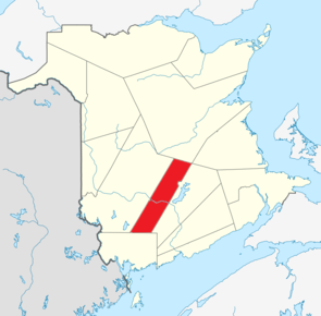 Lage der Region in New Brunswick | |
| Basisdaten | |
| Staat | Kanada |
| Provinz | New Brunswick
|
| Koordinaten: | 45° 55′ N, 66° 20′ W45.916667-66.333333Koordinaten: 45° 55′ N, 66° 20′ W |
| Einwohner | 27.644 (Stand: 2016) |
| Fläche | 2.696,53 km² |
| Bevölkerungsdichte | 10,3 Einw./km² |
| Gründung | 1785 |
| Zeitzone: | Atlantic Standard Time (UTC−4) Atlantic Daylight Time (UTC−3, Sommerzeit) |

Sunbury County (französisch Comté de Sunbury) ist ein County in der kanadischen Provinz New Brunswick. Es umfasst ein Areal von 2696,53 km².[1] Die Einwohnerzahl betrug im Jahr 2016 27.644.[1]
Lage
Das County befindet sich im zentralen Südwesten der Provinz.
Verwaltungsgliederung
Städte und Gemeinden
Es gibt 3 Gemeinden im Sunbury County:[1]
| Name | Status | Fläche km2 | Einwohnerzahl 2016 | Parish |
|---|---|---|---|---|
| Fredericton Junction | Village | 23,85 | 704 | Gladstone |
| Oromocto | Town | 22,44 | 9223 | Burton |
| Tracy | Village | 29,46 | 608 | Gladstone |
Indianerreservate
Im Sunbury County befindet sich ein Reservat:[1]
| Name | Fläche km2 | Einwohnerzahl 2016 | Parish |
|---|---|---|---|
| Oromocto 26 | 1,80 | 327 | Burton |
Parishes
Das County ist in 7 Parishes unterteilt:
- Blissville Parish
- Burton Parish
- Gladstone Parish
- Lincoln Parish
- Maugerville Parish
- Northfield Parish
- Sheffield Parish
Weblinks
Commons: Sunbury County – Sammlung von Bildern, Videos und Audiodateien
Einzelnachweise

Albert County | Carleton County | Charlotte County | Gloucester County | Kent County | Kings County | Madawaska County | Northumberland County | Queens County | Restigouche County | Saint John County | Sunbury County | Victoria County | Westmorland County | York County


