Arzúa
Municipality in Galicia, Spain
Municipality

Coat of arms
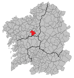
Location of Arzúa within Galicia
(2018)[1]
Arzúa (Galician pronunciation: [aɾˈzu.a], Spanish pronunciation: [aɾˈθu.a]) is a municipality in the province A Coruña, in the autonomous community of Galicia, northwestern Spain. It has an area of 155.89 km2, a population of 6,315 (2012 estimate), and a population density of 40.64 people/km2. It is one of the Galician municipalities with more cows per capita rate in Galicia.
Although the region has long been settled, even pre-dating Roman occupation, the current population of the town are mostly of Basque extraction.[2]
The village is for many pilgrims the last stopping point before the last day trek into Santiago de Compostella. The French Way and the Northern Way (Camino del Norte) of Camino join in a single path in Arzúa before arriving to Santiago.
Demographics
| Year | Pop. | ±% |
|---|---|---|
| 1900 | 9,036 | — |
| 1930 | 8,743 | −3.2% |
| 1950 | 10,754 | +23.0% |
| 1981 | 7,377 | −31.4% |
| 2012 | 6,315 | −14.4% |
| Source: Article in Spanish and Galician | ||
Cuisine
The municipalities of Arzúa and A Ulloa are notable for being the location of origin of Arzúa-Ulloa cheese, which holds Protected designation of origin (PDO) status.[3]
References
- ^ Municipal Register of Spain 2018. National Statistics Institute.
- ^ Gitlitz & Davidson, The Pilgrimage Road to Santiago: The Complete Cultural Handbook, 2000, St Martin's Press, ISBN 0-312-25416-4
- ^ "Arzúa-Ulloa Cheese in Spain: spanish food from Galicia | Spain.info in English". www.Spain.info. Archived from the original on 2013-05-24.
- v
- t
- e
Municipalities of the province of A Coruña
- Abegondo
- Ames
- Aranga
- Ares
- Arteixo
- Arzúa
- A Baña
- Bergondo
- Betanzos
- Boimorto
- Boiro
- Boqueixón
- Brión
- Cabana de Bergantiños
- Cabanas
- Camariñas
- Cambre
- A Capela
- Carballo
- Cariño
- Carnota
- Carral
- Cedeira
- Cee
- Cerceda
- Cerdido
- Coirós
- Corcubión
- Coristanco
- A Coruña
- Culleredo
- Curtis
- Dodro
- Dumbría
- Fene
- Ferrol
- Fisterra
- Frades
- Irixoa
- A Laracha
- Laxe
- Lousame
- Malpica de Bergantiños
- Mañón
- Mazaricos
- Melide
- Mesía
- Miño
- Moeche
- Monfero
- Mugardos
- Muros
- Muxía
- Narón
- Neda
- Negreira
- Noia
- Oleiros
- Ordes
- Oroso
- Ortigueira
- Outes
- Oza-Cesuras
- Paderne
- Padrón
- O Pino
- A Pobra do Caramiñal
- Ponteceso
- Pontedeume
- As Pontes de García Rodríguez
- Porto do Son
- Rianxo
- Ribeira
- Rois
- Sada
- San Sadurniño
- Santa Comba
- Santiago de Compostela
- Santiso
- Sobrado
- As Somozas
- Teo
- Toques
- Tordoia
- Touro
- Trazo
- Val do Dubra
- Valdoviño
- Vedra
- Vilarmaior
- Vilasantar
- Vimianzo
- Zas

| Authority control databases |
|
|---|
42°53′N 8°11′W / 42.883°N 8.183°W / 42.883; -8.183
 | This article about a location in the autonomous community of Galicia, Spain is a stub. You can help Wikipedia by expanding it. |
- v
- t
- e


