Crisnée
Municipality in French Community, Belgium
Crisnée Crusnêye (Walloon) | |
|---|---|
Municipality | |
 | |
 Flag  Coat of arms | |
Location of Crisnée  | |
  Crisnée Location in Belgium Location of Crisnée in the province of Liège 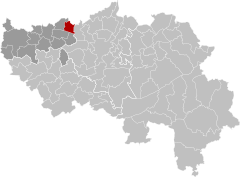 | |
| Coordinates: 50°43′N 05°24′E / 50.717°N 5.400°E / 50.717; 5.400 | |
| Country |  Belgium Belgium |
| Community | French Community |
| Region | Wallonia |
| Province | Liège |
| Arrondissement | Waremme |
| Government | |
| • Mayor | Philippe Goffin (MR) |
| • Governing party/ies | Maïeur |
| Area | |
| • Total | 16.97 km2 (6.55 sq mi) |
| Population (2018-01-01)[1] | |
| • Total | 3,352 |
| • Density | 200/km2 (510/sq mi) |
| Postal codes | 4367 |
| NIS code | 64021 |
| Area codes | 04 |
| Website | www.crisnee.be |
Crisnée (French pronunciation: [kʁisne]; Walloon: Crusnêye) is a municipality of Wallonia located in the province of Liège, Belgium.
It covers an area of 16.83 km2 and on 1 January 2013 had a total population of 3,094, giving a population density on that date of 184 inhabitants per km2.
The municipality consists of the following districts: Crisnée, Fize-le-Marsal, Kemexhe, Odeur, and Thys.
Crisnée is twinned with the commune of Sansais, Nouvelle-Aquitaine, in western France.

See also
References
- ^ "Wettelijke Bevolking per gemeente op 1 januari 2018". Statbel. Retrieved 9 March 2019.
External links
 Media related to Crisnée at Wikimedia Commons
Places adjacent to Crisnée | |
|---|---|


- v
- t
- e
Municipalities in the province of Liège, Wallonia

- Bold indicates cities
- Italic indicates municipalities with language facilities
Authority control databases | |
|---|---|
| International |
|
| National |
|
 | This Liège Province location article is a stub. You can help Wikipedia by expanding it. |
- v
- t
- e


