Damavand, Iran
City in Tehran province, Iran
City in Tehran, Iran
Damavand Persian: دماوند | |
|---|---|
City | |
 The 15th-century Jame mosque of Damavand | |
| 35°41′46″N 52°02′48″E / 35.69611°N 52.04667°E / 35.69611; 52.04667[1] | |
| Country | Iran |
| Province | Tehran |
| County | Damavand |
| District | Central |
| Population (2016)[2] | |
| • Total | 48,380 |
| Time zone | UTC+3:30 (IRST) |
| Website | Official website |
Damavand (Persian: دماوند)[a] is a city in the Central District of Damavand County, Tehran province, Iran, serving as capital of both the county and the district.[4]
At the 2006 census, its population was 36,433 in 10,279 households.[5] The following census in 2011 counted 37,315 people in 11,455 households.[6] The latest census in 2016 showed a population of 48,380 people in 15,267 households.[2]
Damavand is an ancient and historic city. The name Damavand appears in Sassanid texts (as Dunbawand), and Parthian remains have been found there. The city fell to Arab Muslim invaders in 651 CE. It is close to Iran's tallest peak Mount Damavand, which Ferdowsi mentions abundantly in the Shahnameh. The city has relatively cool weather year-round.
Climate
Damavand has a humid continental climate with hot summers, very cold snowy winters and cool rainy springs and autumns (Köppen: Dsa). The average annual temperature is 9.6°C in Damavand.
| Climate data for Damavand | |||||||||||||
|---|---|---|---|---|---|---|---|---|---|---|---|---|---|
| Month | Jan | Feb | Mar | Apr | May | Jun | Jul | Aug | Sep | Oct | Nov | Dec | Year |
| Mean daily maximum °C (°F) | −1.1 (30.0) | 0.4 (32.7) | 6 (43) | 12.4 (54.3) | 19.1 (66.4) | 25.1 (77.2) | 27.6 (81.7) | 26.5 (79.7) | 22.3 (72.1) | 15.5 (59.9) | 6.2 (43.2) | 1.2 (34.2) | 13.4 (56.2) |
| Daily mean °C (°F) | −4.3 (24.3) | −2.8 (27.0) | 2.5 (36.5) | 8.5 (47.3) | 14.9 (58.8) | 20.5 (68.9) | 23 (73) | 22 (72) | 18.2 (64.8) | 11.8 (53.2) | 2.8 (37.0) | −2 (28) | 9.6 (49.2) |
| Mean daily minimum °C (°F) | −7.9 (17.8) | −6.5 (20.3) | −1.7 (28.9) | 3.8 (38.8) | 9.7 (49.5) | 14.5 (58.1) | 17.3 (63.1) | 16.6 (61.9) | 13.6 (56.5) | 8.1 (46.6) | −0.8 (30.6) | −5.5 (22.1) | 5.1 (41.2) |
| Average precipitation mm (inches) | 39 (1.5) | 46 (1.8) | 62 (2.4) | 53 (2.1) | 32 (1.3) | 12 (0.5) | 11 (0.4) | 8 (0.3) | 8 (0.3) | 26 (1.0) | 39 (1.5) | 38 (1.5) | 374 (14.6) |
| Average precipitation days (≥ 1.0 mm) | 6 | 7 | 7 | 7 | 5 | 2 | 2 | 1 | 2 | 4 | 6 | 5 | 54 |
| Average relative humidity (%) | 59 | 61 | 56 | 49 | 35 | 27 | 30 | 30 | 30 | 41 | 60 | 60 | 45 |
| Source: https://en.climate-data.org/asia/iran/tehran/damavand-768465/ | |||||||||||||
Economy
Damavand is an agricultural city and due to its streams, rivers, springs and temperate climate, it has numerous gardens and fields. An important part of the city's economy is provided by the export of tree products. Apples, pears, cherries, apricots, walnuts, apricots, tomatoes, wheat, potatoes, beans and cucumbers are some of the products of this city, some of which, like apples and pears, are famous and distinguished in terms of type. In recent years, beekeeping has become one of the sources of income for the people of this city and Damavand honey competes with the best honey in Iran in terms of quality and constitutes a significant part of the city's exports. New style livestock has been developed in Damavand for several years and the obtained products are exported to Tehran in addition to meeting the needs of the region.
Transportation
Damavand can be reached by road from Firuzkuh via Gilavand and from Haraz road, via Mosha.
Historical attractions
Damavand contains 37 historical tombs (Imamzadeh), 27 castle ruins, 23 traditional houses of architectural significance, 18 traditional bath houses, 6 caves, 5 historical bridges, 3 historical mosques, and 3 caravanserais.
The main landmarks are the Friday Mosque (15th century) and the Sheikh Shebli Mausoleum and Tower, dating to the Seljuq era.
-
 View of Damavand and the Alborz Mountains
 -
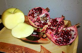 Damavand's pomegranate and apple
 -


See also
Wikimedia Commons has media related to Damavand.
 Iran portal

Notes
References
- ^ OpenStreetMap contributors (18 March 2024). "Damavand, Damavand County" (Map). OpenStreetMap. Retrieved 18 March 2024.
- ^ a b "Census of the Islamic Republic of Iran, 1395 (2016)". AMAR (in Persian). The Statistical Center of Iran. p. 23. Archived from the original (Excel) on 12 December 2021. Retrieved 19 December 2022.
- ^ Damavand, Iran can be found at GEOnet Names Server, at this link, by opening the Advanced Search box, entering "-3059147" in the "Unique Feature Id" form, and clicking on "Search Database".
- ^ Habibi, Hassan (21 June 1369). "Approval of the organization and chain of citizenship of the elements and units of the national divisions of Tehran province centered on the city of Tehran". Islamic Parliament Research Center (in Persian). Ministry of Interior, Political-Defense Commission of the Government Board. Archived from the original on 30 November 2014. Retrieved 16 December 2023.
- ^ "Census of the Islamic Republic of Iran, 1385 (2006)". AMAR (in Persian). The Statistical Center of Iran. p. 23. Archived from the original (Excel) on 20 September 2011. Retrieved 25 September 2022.
- ^ "Census of the Islamic Republic of Iran, 1390 (2011)". Syracuse University (in Persian). The Statistical Center of Iran. p. 23. Archived from the original (Excel) on 20 January 2023. Retrieved 19 December 2022.
External links
- Photo from Saha Air 707 at Airliners.net
Authority control databases | |
|---|---|
| International |
|
| National |
|
| Other |
|
- v
- t
- e
Tehran Province, Iran
and cities

- Azadi Tower
- Bahman Cultural Center
- Tabiat Bridge
- Carpet Museum of Iran
- Dizin
- Ebn-e Babooyeh
- Golestan Palace
- Grand Bazaar, Tehran
- Iranian Crown Jewels
- Malik National Museum of Iran
- Milad Tower
- National Museum of Iran
- Niavaran Complex
- Pearl Palace
- Sa'dabad Complex
- Shebeli Tower
- Shemshak (ski resort)
- Bibi Shahr Banu Shrine
- Tangeh Savashi
- Tehran Museum of Contemporary Art
- Toopkhaneh
- Tughrul Tower
- Reza Abbasi Museum
- St. Thaddeus and Bartholomew Church
- St. George Church
^* indicates that this formerly independent city is now absorbed into Tehran.
| |||||||||||||||||||||||
|---|---|---|---|---|---|---|---|---|---|---|---|---|---|---|---|---|---|---|---|---|---|---|---|
| Capital |
| ||||||||||||||||||||||
| Districts |
| ||||||||||||||||||||||

 | This Damavand County location article is a stub. You can help Wikipedia by expanding it. |
- v
- t
- e


