Eagle City, Oklahoma
Unincorporated community and Census designated place in Oklahoma, United States
35°56′02″N 98°35′24″W / 35.93389°N 98.59000°W / 35.93389; -98.59000 (2020)
73658
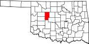
Eagle City is a small rural community located along and west of State Highway 58 in western Blaine County, Oklahoma, United States.[2] Established on the Frisco Line before statehood, the post office which opened July 26, 1902 was named Dillon. The name was changed to Eagle City September 4, 1909.[3] The ZIP Code is 73658. The nearest post office is now in Oakwood.[4]
Demographics
| Census | Pop. | Note | %± |
|---|---|---|---|
| 2020 | 40 | — | |
| U.S. Decennial Census[5] | |||
References
- ^ "ArcGIS REST Services Directory". United States Census Bureau. Retrieved September 20, 2022.
- ^ a b c U.S. Geological Survey Geographic Names Information System: Eagle City, Oklahoma
- ^ Shirk, George H. Oklahoma Place Names, Norman, Oklahoma: University of Oklahoma Press, 1965, p.68.
- ^ "Find USPS Locations-Eagle City, Oklahoma". U.S. Postal Service. Retrieved March 18, 2024.
- ^ "Census of Population and Housing". Census.gov. Retrieved June 4, 2016.
External links
- Eagle City at GhostTowns.com
- v
- t
- e
Municipalities and communities of Blaine County, Oklahoma, United States
County seat: Watonga
- Geary‡
- Watonga
- Eagle City
- Homestead
‡This populated place also has portions in an adjacent county or counties
- Oklahoma portal
- United States portal
 | This Oklahoma state location article is a stub. You can help Wikipedia by expanding it. |
- v
- t
- e


