Finnish national road 3
Highway in Finland
You can help expand this article with text translated from the corresponding article in Finnish. (June 2023) Click [show] for important translation instructions.
- Machine translation, like DeepL or Google Translate, is a useful starting point for translations, but translators must revise errors as necessary and confirm that the translation is accurate, rather than simply copy-pasting machine-translated text into the English Wikipedia.
- Do not translate text that appears unreliable or low-quality. If possible, verify the text with references provided in the foreign-language article.
- You must provide copyright attribution in the edit summary accompanying your translation by providing an interlanguage link to the source of your translation. A model attribution edit summary is
Content in this edit is translated from the existing Finnish Wikipedia article at [[:fi:Valtatie 3]]; see its history for attribution. - You may also add the template
{{Translated|fi|Valtatie 3}}to the talk page. - For more guidance, see Wikipedia:Translation.
 | |
|---|---|
| |
| Hämeenlinna Highway, Tampere Highway | |
 | |
 | |
| Route information | |
Part of  E12 E12 | |
| Maintained by the Finnish Road Administration | |
| Length | 424 km (263 mi) |
| Major junctions | |
| From | Helsinki |
| To | Vaasa |
| Location | |
| Country | Finland |
| Major cities | Hämeenlinna, Tampere |
| Highway system | |
| |
Finnish national road 3 (Finnish: Valtatie 3 or Kolmostie; Swedish: Riksväg 3) is a highway in Finland between Helsinki and Vaasa via Hämeenlinna and Tampere. The road is 424 kilometres (263 mi) long and it is part of the European route E12. 180 kilometres (110 mi) of the highway is motorway, connecting Helsinki to Tampere. North of Tampere, the road is mostly two-lane road, with a share of 2+1 road. The busiest point on Highway 3 is in Helsinki, north of the Ring I junction, where the average traffic volume is about 90,000 vehicles per day.[1]
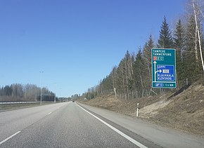
Back in the late 1950s before the current freeway, the Finnish regional road 132 (Mt 132) was the former main road to Hämeenlinna and Tampere via Loppi and Janakkala.[2]
Route

The route of the road is: Helsinki – Vantaa – Nurmijärvi – Hyvinkää – Riihimäki – Janakkala – Hämeenlinna – Hattula – Kalvola – Valkeakoski – Akaa – Valkeakoski (again) – Lempäälä – Tampere – Pirkkala – Nokia – Tampere (again) – Ylöjärvi – Hämeenkyrö – Ikaalinen – Parkano – Jalasjärvi – Kurikka – Ilmajoki – Isokyrö – Laihia – Korsholm – Vaasa.
Highway 3 starts in Helsinki at the end of the Mannerheimintie street. Between the Kivihaka and Ring III, Highway 3 is a high-quality four-lane highway, all connections of which are interchanges (except the motorway). The entire section between Ring III and the town of Ylöjärvi is a four-lane motorway. At 180 kilometres long, it is the longest motorway in Finland. In the Greater Helsinki, the road is also called Hämeenlinnanväylä, sometimes in colloquial language also Tampereenväylä. The former name of the road is Nurmijärventie, referring to the municipality of Nurmijärvi along the way. The traffic volumes on the highway are quite high all the way. For example, in the case of Riihimäki, the volume of road traffic is about 30,000 vehicles per day.[3]
Highway 3 runs right next to the city center at Hämeenlinna. This throughway is the first section of the road and the third section of the Finnish motorway, which was completed in 1964. Today, the road runs for about 200 meters in a tunnel, when the Goodman Shopping Center [fi] in Hämeenlinna was completed in 2014 on the pavement.[4] Attention has also been paid to the aesthetics of the highway environment. Some of the bridges at Highway 3 can be considered almost works of art and the rock cuts have been illuminated. Ekku Peltomäki's light art work Lux Tavastia is next to Akaa's Terisjärvi.[5]
To the south of Tampere city center, Highway 3 turns onto Tampere's western ring road, which is also a motorway. The western ring road was completed as a two-lane road, partly as a two-lane expressway in 1985.[6] The motorway ends slightly west of the center of Ylöjärvi, and the highway turns from the ring road at the Elovainio interchange to the road between Tampere and Vaasa. Between Ylöjärvi and Vaasa, Highway 3 is a standard Finnish two-lane highway, the quality of which varies. Some of the major interfaces have been upgraded to intermodal interfaces.[clarification needed] In addition, there is an 11-kilometre-long motorway between Korsholm's Helsingby and Vaasa. The road ends in the center of Vaasa.[7]
See also
References
- ^ "Suomen tieverkon vilkkain kohta löytyy Pohjois-Helsingistä, lähes 100 000 autoa päivässä". Etelä-Suomen Sanomat (in Finnish). 19 March 2018. Retrieved 18 April 2021.
- ^ Grönroos, Matti (29 April 2015). "Teillä ja turuilla: Klaukkala" (in Finnish). Retrieved 19 April 2021.
- ^ "Hämeenlinnan moottoritiepäätöksestä 50 vuotta". YLE (in Finnish). 18 January 2012. Retrieved 18 April 2021.
- ^ Välimäki, Ville (9 October 2014). "Kauppakeskus Goodman kauppiaita vaille valmis – käy videokierroksella!". YLE (in Finnish). Retrieved 18 April 2021.
- ^ Tieliikennelaitoksen sidosryhmälehti VIA, 3/2005 Archived 2007-11-14 at the Wayback Machine (in Finnish)
- ^ Jaakko Masonen & Mauno Hänninen (1995). Tuhat vuotta tietä, kaksisataa vuotta tielaitosta. 3. Pikeä, hikeä, autoja. Tiet, liikenne ja yhteiskunta 1945–2005 (in Finnish). Helsinki: Tielaitos & Painatuskeskus. p. 272. ISBN 951-37-1621-X.
- ^ Teillä ja turuilla: Vaasa (in Finnish)
External links
![]() Media related to National road 3 (Finland) at Wikimedia Commons
Media related to National road 3 (Finland) at Wikimedia Commons
- Matti Grönroos – Valtatie 3 (in Finnish)
- v
- t
- e


 | This European road or road transport-related article is a stub. You can help Wikipedia by expanding it. |
- v
- t
- e
 | This article about transport in Finland is a stub. You can help Wikipedia by expanding it. |
- v
- t
- e


