Hook, East Riding of Yorkshire
Village and civil parish in the East Riding of Yorkshire, England
Human settlement in England
- Hook
- Brigg and Goole
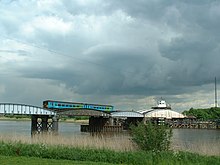
Hook is a village and civil parish in the East Riding of Yorkshire, England. It is situated approximately 1.5 miles (2.4 km) north-east of Goole town centre and lies on the west bank of the River Ouse.
According to the 2011 UK census, Hook parish had a population of 1,292,[1] an increase on the 2001 UK census figure of 1,141.[2]

The parish was part of the Goole Rural District in the West Riding of Yorkshire from 1894 to 1974, then in the Boothferry district of Humberside until 1996.[4]
The church dedicated to St Mary the Virgin was designated a Grade II* listed building in 1967 and is now recorded in the National Heritage List for England, maintained by Historic England.[5]
The village has a nearby local school: Hook Church Of England Primary School.[6] There is also a small local post office and two public houses. The village has a number of building sites for the purpose of housing development.
Nearby, Goole has facilities, including Tesco, Morrisons, and Asda supermarkets, as well as several chain shops, schools, a hospital, and a railway station with services to Hull, Doncaster, and Leeds.
References
- ^ a b UK Census (2011). "Local Area Report – Hook Parish (1170211201)". Nomis. Office for National Statistics. Retrieved 20 February 2018.
- ^ UK Census (2001). "Local Area Report – Hook Parish (00FB072)". Nomis. Office for National Statistics. Retrieved 26 February 2020.
- ^ Historic England. "Railway Swing Bridge Over River Ouse (1346710)". National Heritage List for England. Retrieved 14 September 2020.
- ^ "History of Hook, in East Riding of Yorkshire and West Riding | Map and description". www.visionofbritain.org.uk. Retrieved 25 November 2020.
- ^ Historic England. "Church of St Mary (1160360)". National Heritage List for England. Retrieved 16 August 2013.
- ^ "About Us". Hook C of E Primary School. Retrieved 14 September 2020.
- Gazetteer — A–Z of Towns Villages and Hamlets. East Riding of Yorkshire Council. 2006. p. 7.
Wikimedia Commons has media related to Hook.
Portals:
 Yorkshire
 England
 United Kingdom

- v
- t
- e

Yorkshire Portal
(cities in italics)
 | This East Riding of Yorkshire location article is a stub. You can help Wikipedia by expanding it. |
- v
- t
- e


