Huldenberg
Municipality in Flemish Community, Belgium

Flag

Coat of arms
Location of Huldenberg


Huldenberg
Location in Belgium 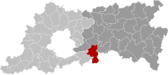
Location of Huldenberg in Flemish Brabant

 Belgium
 (2018-01-01)[1]
3040
24045
Huldenberg (Dutch pronunciation: [ˈɦʏldə(m)bɛr(ə)x]) is a municipality located in the Belgian province of Flemish Brabant. The municipality comprises the towns and villages of Huldenberg proper, Loonbeek, Neerijse [nl], Ottenburg and Sint-Agatha-Rode. On January 1, 2011, Huldenberg had a total population of 9,464. The total area is 39.64 km² which gives a population density of 230 inhabitants per km².
It is the seat of the Belgian branch of the House of Limburg-Stirum.
It has a football club called VK Huldenberg, which was created from a fusion of the clubs FC Huldenberg and VK Rode.[2]
Every Tuesday there is a market from 8h - 13h. This market is located at the Gemeenteplein, near town hall.
At the end of WW II, Mary Churchill, daughter of the British prime minister, was a member of a British all-women anti-aircraft battery 481 that was stationed at Huldenberg for three months. She was entertained by the then burgomaster of Huldenberg, Count Thierry de Limburg Stirum and his wife Marie,[3] née Princess of Croÿ. She noted that she found the local people very friendly and helpful and stated ("somewhat priggishly" she admitted) "...the flouting by all of and sundry of whatever regulations existed here, and the wide-spread use of the flourishing 'black market'. This had been regarded as almost a 'patriotic duty' during the occupation, but it was still going on now - apparently unrestrained."[3]
Gallery
-
 Church in Huldenberg
 -
 The Peuthystraat entering the center of Huldenberg
 -
 Freedomtree (Vrijheidsboom) (platanus) and a monument from 1906
 -
 St.-Rochuschapel built in 1727
 -
 Municipality house Huldenberg
 -
 Aerial view of Huldenberg
 -
 Castle of Huldenberg, belonging to the counts of Limburg-Stirum


References
- ^ "Wettelijke Bevolking per gemeente op 1 januari 2018". Statbel. Retrieved 9 March 2019.
- ^ "Voetbal (Football) OHR Huldenberg vzw". Gemeente Huldenberg (Huldenberg town council). 2014. Retrieved 25 March 2016.
- ^ a b Soames, Mary (2011). A Daughter's Tale. Croydon, UK: Doubleday. pp. 327–334. ISBN 978-0-385-60448-2.
External links
![]() Media related to Huldenberg at Wikimedia Commons
Media related to Huldenberg at Wikimedia Commons
- Official website
- Gazetteer Entry
- Huldenberg Blues
Places adjacent to Huldenberg | ||||||||||||||||
|---|---|---|---|---|---|---|---|---|---|---|---|---|---|---|---|---|
| ||||||||||||||||


- v
- t
- e
- Affligem
- Asse
- Beersel
- Bever
- Dilbeek
- Drogenbos
- Galmaarden
- Gooik
- Grimbergen
- Halle
- Herne
- Hoeilaart
- Kampenhout
- Kapelle-op-den-Bos
- Kraainem
- Lennik
- Liedekerke
- Linkebeek
- Londerzeel
- Machelen
- Meise
- Merchtem
- Opwijk
- Overijse
- Pepingen
- Roosdaal
- Sint-Genesius-Rode
- Sint-Pieters-Leeuw
- Steenokkerzeel
- Ternat
- Vilvoorde
- Wemmel
- Wezembeek-Oppem
- Zaventem
- Zemst

- Bold indicates cities
- Italic indicates municipalities with language facilities
Authority control databases | |
|---|---|
| International |
|
| Geographic |
|
 | This Flemish Brabant location article is a stub. You can help Wikipedia by expanding it. |
- v
- t
- e


