Jones, Alabama
Unincorporated community in Alabama, United States
Unincorporated community in Alabama, United States
32°35′2″N 86°53′50″W / 32.58389°N 86.89722°W / 32.58389; -86.8972236749
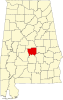
Jones, originally Jones Switch, is an unincorporated community in Autauga County, Alabama, United States.[1] The name was officially shortened on May 1, 1903. The community has a post office, with postmasters appointed from 1878 to 2006.[2][3] The post office also serves unincorporated areas of Autauga County such as Vine Hill, Fremont, Bethel, Salem, Milton, and Fig Tree.
Geography
Jones is located at 32°35′02″N 86°53′51″W / 32.58402°N 86.89748°W / 32.58402; -86.89748 and has an elevation of 200 feet (61 m).[1] Mulberry Creek is located to the west and rolling hills are located to the east.
Emergency Services
Fire protection is provided by the Jones Volunteer Fire Department.
Emergency Medical Services are provided by Haynes Ambulance.
Law enforcement agency is the Autauga County Sheriffs Office.
References
- v
- t
- e
Municipalities and communities of Autauga County, Alabama, United States
County seat: Prattville
- Millbrook‡
- Prattville‡
communities
‡This populated place also has portions in an adjacent county or counties
- Alabama portal
- United States portal
 | This Autauga County, Alabama state location article is a stub. You can help Wikipedia by expanding it. |
- v
- t
- e


