Kaarina
You can help expand this article with text translated from the corresponding article in Finnish. (October 2014) Click [show] for important translation instructions.
- Machine translation, like DeepL or Google Translate, is a useful starting point for translations, but translators must revise errors as necessary and confirm that the translation is accurate, rather than simply copy-pasting machine-translated text into the English Wikipedia.
- Do not translate text that appears unreliable or low-quality. If possible, verify the text with references provided in the foreign-language article.
- You must provide copyright attribution in the edit summary accompanying your translation by providing an interlanguage link to the source of your translation. A model attribution edit summary is
Content in this edit is translated from the existing Finnish Wikipedia article at [[:fi:Kaarina]]; see its history for attribution. - You may also add the template
{{Translated|fi|Kaarina}}to the talk page. - For more guidance, see Wikipedia:Translation.
Town in Southwest Finland, Finland
Kaarina S:t Karins | |
|---|---|
Town | |
| Kaarinan kaupunki S:t Karins stad | |
 | |
 Coat of arms | |
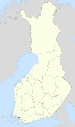 Location of Kaarina in Finland | |
| Coordinates: 60°24′N 022°22′E / 60.400°N 22.367°E / 60.400; 22.367 | |
| Country |  Finland Finland |
| Region | Southwest Finland |
| Sub-region | Turku sub-region |
| Metropolitan area | Turku metropolitan area |
| Charter | 1869 |
| Government | |
| • Town manager | Harri Virta |
| Area (2018-01-01)[1] | |
| • Total | 179.58 km2 (69.34 sq mi) |
| • Land | 150.57 km2 (58.14 sq mi) |
| • Water | 29.15 km2 (11.25 sq mi) |
| • Rank | 276th largest in Finland |
| Population (2023-12-31)[2] | |
| • Total | 36,339 |
| • Rank | 32nd largest in Finland |
| • Density | 241.34/km2 (625.1/sq mi) |
| Population by native language | |
| • Finnish | 88.7% (official) |
| • Swedish | 4.9% |
| • Others | 6.3% |
| Population by age | |
| • 0 to 14 | 18.5% |
| • 15 to 64 | 60.3% |
| • 65 or older | 21.2% |
| Time zone | UTC+02:00 (EET) |
| • Summer (DST) | UTC+03:00 (EEST) |
| Climate | Dfb |
| Website | kaarina |
Kaarina (Finnish pronunciation: [ˈkɑːrinɑ]; Swedish: S:t Karins, i.e. "Saint Catherine's") is a town in Finland, located in the region of Southwest Finland. It lies south of the regional capital, Turku. The population of Kaarina is approximately 36,000, while the sub-region has a population of approximately 347,000. It is the 32nd most populous municipality in Finland, and the second largest municipality in the Southwest Finland region after Turku.
Kaarina has an area of 179.58 square kilometres (69.34 sq mi) of which 29.15 km2 (11.25 sq mi) is water.[1] The population density is 241.34 inhabitants per square kilometre (625.1/sq mi).
The municipality is unilingual Finnish, with a Swedish minority and a Swedish comprehensive school. Bilingualism was proposed but rejected in 2015.
The famous artist Tom of Finland was born in Kaarina. Kaarina has a football team called Kaarinan Pojat. The Kino Piispanristi[6] is the largest independent cinema in Southwest Finland.
The municipality of Kuusisto was merged with Kaarina in 1946. The municipality of Piikkiö was merged with Kaarina in 2009. At the same time, Kaarina adopted Piikkiö's coat of arms.
Climate
| Climate data for Kaarina Yltöinen (1991-2020 normals, extremes 1959- present) | |||||||||||||
|---|---|---|---|---|---|---|---|---|---|---|---|---|---|
| Month | Jan | Feb | Mar | Apr | May | Jun | Jul | Aug | Sep | Oct | Nov | Dec | Year |
| Record high °C (°F) | 8.8 (47.8) | 10.0 (50.0) | 14.1 (57.4) | 22.9 (73.2) | 29.3 (84.7) | 31.2 (88.2) | 33.2 (91.8) | 32.2 (90.0) | 26.2 (79.2) | 18.6 (65.5) | 14.1 (57.4) | 11.0 (51.8) | 33.2 (91.8) |
| Mean daily maximum °C (°F) | −0.9 (30.4) | −1.1 (30.0) | 2.8 (37.0) | 8.9 (48.0) | 15.4 (59.7) | 19.6 (67.3) | 22.5 (72.5) | 21.3 (70.3) | 16.1 (61.0) | 9.3 (48.7) | 4.1 (39.4) | 1.1 (34.0) | 9.9 (49.8) |
| Daily mean °C (°F) | −3.6 (25.5) | −4.3 (24.3) | −1.3 (29.7) | 4.0 (39.2) | 10.0 (50.0) | 14.5 (58.1) | 17.5 (63.5) | 16.2 (61.2) | 11.5 (52.7) | 6.0 (42.8) | 1.9 (35.4) | −1.3 (29.7) | 5.9 (42.6) |
| Mean daily minimum °C (°F) | −6.9 (19.6) | −7.9 (17.8) | −5.2 (22.6) | −0.5 (31.1) | 4.3 (39.7) | 9.1 (48.4) | 12.2 (54.0) | 11.2 (52.2) | 7.2 (45.0) | 2.8 (37.0) | −0.7 (30.7) | −4.1 (24.6) | 1.8 (35.2) |
| Record low °C (°F) | −36.7 (−34.1) | −37.4 (−35.3) | −30.0 (−22.0) | −18.4 (−1.1) | −7.2 (19.0) | −2.5 (27.5) | 2.0 (35.6) | −0.6 (30.9) | −8.0 (17.6) | −16.8 (1.8) | −23.5 (−10.3) | −35.8 (−32.4) | −37.4 (−35.3) |
| Average precipitation mm (inches) | 54 (2.1) | 41 (1.6) | 37 (1.5) | 32 (1.3) | 35 (1.4) | 57 (2.2) | 71 (2.8) | 78 (3.1) | 56 (2.2) | 74 (2.9) | 67 (2.6) | 68 (2.7) | 671 (26.4) |
| Average precipitation days (≥ 0.1 mm) | 19 | 15 | 13 | 11 | 10 | 12 | 13 | 14 | 13 | 16 | 18 | 20 | 174 |
| Average relative humidity (%) | 92 | 89 | 82 | 75 | 71 | 73 | 77 | 81 | 85 | 89 | 93 | 92 | 83 |
| Source 1: https://helda.helsinki.fi/items/d7ce3a4f-bf47-4453-be76-2a0de738c59a | |||||||||||||
| Source 2: https://kilotavu.com/asema-taulukko.php?asema=100934 | |||||||||||||
Politics
Results of the 2011 Finnish parliamentary election in Kaarina:
- National Coalition Party 29.7%
- Social Democratic Party 21.2%
- True Finns 17.8%
- Left Alliance 9.5%
- Green League 7.1%
- Centre Party 6.6%
- Swedish People's Party 3.4%
- Christian Democrats 2.8%
Images
-
 Residential blocks in Kaarina
 -
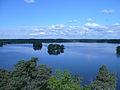 Lake Littoistenjärvi
 -
 Dance pavilion in Littoinen
 -
 Ravattula


International relations
Twin towns — Sister cities
 Ansião, Portugal
 Jõgeva, Estonia
 Enköping, Sweden
 Szentes, Hungary
 Sovetsky, Russia (on ice due to Russian invasion of Ukraine)[8]


See also
References
- ^ a b "Area of Finnish Municipalities 1.1.2018" (PDF). National Land Survey of Finland. Retrieved 30 January 2018.
- ^ "Population growth biggest in nearly 70 years". Population structure. Statistics Finland. 2024-04-26. ISSN 1797-5395. Retrieved 2024-04-29.
- ^ "Population growth biggest in nearly 70 years". Population structure. Statistics Finland. 2024-04-26. ISSN 1797-5395. Retrieved 2024-04-29.
- ^ "Population according to age (1-year) and sex by area and the regional division of each statistical reference year, 2003–2020". StatFin. Statistics Finland. Retrieved 2 May 2021.
- ^ a b "Luettelo kuntien ja seurakuntien tuloveroprosenteista vuonna 2023". Tax Administration of Finland. 14 November 2022. Retrieved 7 May 2023.
- ^ "Meistä – Kino Piispanristi". Kino Piispanristi (in Finnish). Retrieved 2022-10-15.
- ^ "Kaarinalla on viisi ystävyyskaupunkia" (in Finnish). City of Kaarina. 7 April 2015. Archived from the original on 15 December 2014. Retrieved 3 September 2019.
- ^ "Ukrainan sota katkaisi ystävyyden Kaarinan ja entisen Johanneksen väliltä – Johannes-seuran puheenjohtaja moittii ratkaisua". Kaarina-lehti (in Finnish). 2022-03-08. Retrieved 2023-03-31.
External links
 Kaarina travel guide from Wikivoyage
 Media related to Kaarina at Wikimedia Commons
- Official website


- v
- t
- e

- Alastaro
- Angelniemi
- Askainen
- Dragsfjärd
- Halikko
- Hitis
- Houtskär
- Iniö
- Kakskerta
- Kalanti
- Karinainen
- Karjala
- Karuna
- Kimito
- Kiikala
- Kisko
- Korpo
- Kuusisto
- Kuusjoki
- Lemu
- Loimaan kunta
- Lokalahti
- Maaria
- Mellilä
- Merimasku
- Metsämaa
- Mietoinen
- Muurla
- Naantalin maalaiskunta
- Nagu
- Paattinen
- Pargas landskommun
- Perniö
- Pertteli
- Piikkiö
- Pyhämaa
- Rymättylä
- Särkisalo
- Somerniemi
- Suomusjärvi
- Tarvasjoki
- Uskela
- Uudenkaupungin maalaiskunta
- Vahto
- Västanfjärd
- Velkua
- Yläne
| ||||||||||||||||||||||||||||||||||||||||||||||||||||||||||||||||||
|---|---|---|---|---|---|---|---|---|---|---|---|---|---|---|---|---|---|---|---|---|---|---|---|---|---|---|---|---|---|---|---|---|---|---|---|---|---|---|---|---|---|---|---|---|---|---|---|---|---|---|---|---|---|---|---|---|---|---|---|---|---|---|---|---|---|---|
| ||||||||||||||||||||||||||||||||||||||||||||||||||||||||||||||||||


Authority control databases | |
|---|---|
| International |
|
| National |
|
| Geographic |
|
 | This Western Finland location article is a stub. You can help Wikipedia by expanding it. |
- v
- t
- e


