Kranichfeld
Town in Thuringia, Germany

Coat of arms
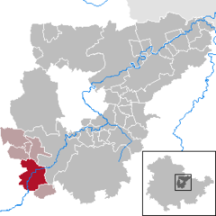
Location of Kranichfeld within Weimarer Land district
(2022–28) Jörg Bauer[1]
(2022-12-31)[2]
99446–99448
Kranichfeld is a town in the Weimarer Land district, in Thuringia. It is situated on the river Ilm, 18 km southeast of Erfurt, and 16 km southwest of Weimar.
History
Within the German Empire (1871-1918), Kranichfeld was part of the Grand Duchy of Saxe-Weimar-Eisenach.
References
- ^ Gewählte Bürgermeister - aktuelle Landesübersicht, Freistaat Thüringen, accessed 10 November 2022.
- ^ "Bevölkerung der Gemeinden, erfüllenden Gemeinden und Verwaltungsgemeinschaften in Thüringen Gebietsstand: 31.12.2022" (in German). Thüringer Landesamt für Statistik. June 2023.
- v
- t
- e
Towns and municipalities in Weimarer Land
- Am Ettersberg
- Apolda
- Bad Berka
- Bad Sulza
- Ballstedt
- Blankenhain
- Buchfart
- Döbritschen
- Eberstedt
- Ettersburg
- Frankendorf
- Grammetal
- Großheringen
- Großschwabhausen
- Hammerstedt
- Hetschburg
- Hohenfelden
- Ilmtal-Weinstraße
- Kapellendorf
- Kiliansroda
- Kleinschwabhausen
- Klettbach
- Kranichfeld
- Lehnstedt
- Magdala
- Mechelroda
- Mellingen
- Nauendorf
- Neumark
- Niedertrebra
- Obertrebra
- Oettern
- Rittersdorf
- Schmiedehausen
- Tonndorf
- Umpferstedt
- Vollersroda
- Wiegendorf

Authority control databases | |
|---|---|
| International |
|
| National |
|
| Geographic |
|
 | This Weimarer Land location article is a stub. You can help Wikipedia by expanding it. |
- v
- t
- e


