Lüder
Municipality in Lower Saxony, Germany

Coat of arms
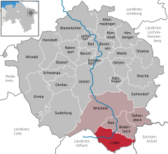
Location of Lüdder within Uelzen district
52°49′N 10°40′E / 52.817°N 10.667°E / 52.817; 10.667
(2022-12-31)[1]
29394
Lüder is a municipality in the district of Uelzen, in Lower Saxony, Germany.
Through the area flows a small river of the same name, with its source in the upland bog of the Völzberger Köpfchen[2] and its mouth where it flows into the Fulda.[3]
References
- ^ "LSN-Online Regionaldatenbank, Tabelle A100001G: Fortschreibung des Bevölkerungsstandes, Stand 31. Dezember 2022" (in German). Landesamt für Statistik Niedersachsen.
- ^ "Lüderquelle (Rechte Lüder)". Google Maps. Google, Inc. Retrieved 8 May 2022.
- ^ "Lüdermündung 36041 Fulda, Germany". Google Maps. Google, Inc. Retrieved 8 May 2022.
- v
- t
- e
Towns and municipalities in Uelzen (district)
- Altenmedingen
- Bad Bevensen
- Bad Bodenteich
- Barum
- Bienenbüttel
- Ebstorf
- Eimke
- Emmendorf
- Gerdau
- Hanstedt
- Himbergen
- Jelmstorf
- Lüder
- Natendorf
- Oetzen
- Rätzlingen
- Römstedt
- Rosche
- Schwienau
- Soltendieck
- Stoetze
- Suderburg
- Suhlendorf
- Uelzen
- Weste
- Wrestedt
- Wriedel

Authority control databases | |
|---|---|
| International |
|
| National |
|
 | This Uelzen (district) location article is a stub. You can help Wikipedia by expanding it. |
- v
- t
- e


