List of historic places in St. John's, Newfoundland and Labrador
This article is a list of historic places in St. John's, Newfoundland and Labrador entered on the Canadian Register of Historic Places, whether they are federal, provincial, or municipal.
Map all coordinates using OpenStreetMap
Download coordinates as:
- KML
- GPX (all coordinates)
- GPX (primary coordinates)
- GPX (secondary coordinates)
List of historic places
| Name | Address | Coordinates | Government recognition (CRHP №) | Image | |
|---|---|---|---|---|---|
| Anderson House | 42 Powers Court St. John's NL | 47°34′22″N 52°41′48″W / 47.5729°N 52.6968°W / 47.5729; -52.6968 (Anderson House) | Newfoundland and Labrador (2242) |  | |
| Angel House Registered Heritage Structure | 146 Hamilton Avenue St. John's NL | 47°33′13″N 52°43′17″W / 47.5537°N 52.7214°W / 47.5537; -52.7214 (Angel House Registered Heritage Structure) | Newfoundland and Labrador (2333), St. John's municipality (6127) |  | |
| Anglican Cathedral Parish House | 9 Cathedral Street St. John's NL | 47°33′57″N 52°42′31″W / 47.5659°N 52.7085°W / 47.5659; -52.7085 (Anglican Cathedral Parish House) | St. John's municipality (2429) |  Upload Photo | |
| Apothecary Hall | 488 Water Street St. John's NL | 47°33′22″N 52°42′51″W / 47.5561°N 52.7142°W / 47.5561; -52.7142 (Apothecary Hall) | Newfoundland and Labrador (2304) | 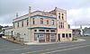 | |
| Bannerman House | 54 Circular Road St. John's NL | 47°34′23″N 52°42′36″W / 47.573°N 52.7101°W / 47.573; -52.7101 (Bannerman House) | Newfoundland and Labrador (2618), St. John's municipality (8062) | 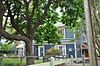 | |
| 008 Barnes Road | 8 Barnes Road St. John's NL | 47°34′07″N 52°42′34″W / 47.5687°N 52.7094°W / 47.5687; -52.7094 (8 Barnes Road) | St. John's municipality (5468) | Upload Photo | |
| 010 Barnes Road | 10 Barnes Road St. John's NL | 47°34′07″N 52°42′34″W / 47.5687°N 52.7094°W / 47.5687; -52.7094 (10 Barnes Road) | St. John's municipality (3298) | Upload Photo | |
| Bartra | 28 Circular Road St. John's NL | 47°34′26″N 52°42′26″W / 47.574°N 52.7071°W / 47.574; -52.7071 (Bartra) | Newfoundland and Labrador (2711), St. John's municipality (10390) | 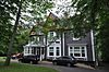 | |
| Basilica of St. John the Baptist National Historic Site of Canada | 172 Military Road St. John's NL | 47°34′02″N 52°42′33″W / 47.5673°N 52.7093°W / 47.5673; -52.7093 (Basilica of St. John the Baptist National Historic Site of Canada) | Federal (4139), Newfoundland and Labrador (3056), St. John's municipality (10491) |  | |
| Basilica Cathedral of St. John the Baptist Entrance Archway Municipal Heritage Building | 200 Military Road St. John's NL | 47°34′02″N 52°42′34″W / 47.5672°N 52.7094°W / 47.5672; -52.7094 (Basilica Cathedral of St. John the Baptist Entrance Archway Municipal Heritage Building) | St. John's municipality (5867) | 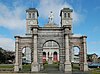 | |
| Benevolent Irish Society (BIS) Building | 48 Queen's Road St. John's NL | 47°34′01″N 52°42′34″W / 47.5669°N 52.7094°W / 47.5669; -52.7094 (Benevolent Irish Society (BIS) Building) | Newfoundland and Labrador (3303) | 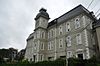 | |
| Bishop Feild College | 46 Bond Street St. John's NL | 47°35′39″N 52°42′22″W / 47.5941°N 52.706°W / 47.5941; -52.706 (Bishop Feild College) | Newfoundland and Labrador (2243), St. John's municipality (5272) | 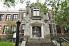 | |
| Bishop's Library | Bonaventure Avenue, between the Bishop's Palace and The Monastery St. John's NL | 47°34′02″N 52°42′44″W / 47.5672°N 52.7121°W / 47.5672; -52.7121 (Bishop's Library) | Newfoundland and Labrador (2188) |  | |
| Bishop's Palace | Bonaventure Avenue St. John's NL | 47°34′03″N 52°42′44″W / 47.5675°N 52.7121°W / 47.5675; -52.7121 (Bishop's Palace) | Newfoundland and Labrador (2289) | 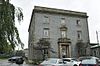 | |
| Building 202 | Former Pepperrell AFB St. John's NL | 47°34′56″N 52°41′45″W / 47.5823°N 52.6957°W / 47.5823; -52.6957 (Building 202) | Federal (11364) | Upload Photo | |
| Building 204 | Former Pepperrell AFB St. John's NL | 47°34′58″N 52°41′39″W / 47.5828°N 52.6942°W / 47.5828; -52.6942 (Building 204) | Federal (11365) | Upload Photo | |
| Building 205 | Former Pepperrell AFB St. John's NL | 47°35′06″N 52°41′39″W / 47.585°N 52.6943°W / 47.585; -52.6943 (Building 205) | Federal (11437) | Upload Photo | |
| Building 206 | Former Pepperrell AFB St. John's NL | 47°35′00″N 52°41′44″W / 47.5832°N 52.6955°W / 47.5832; -52.6955 (Building 206) | Federal (11438) | Upload Photo | |
| Building 207 | Former Pepperrell AFB St. John's NL | 47°35′00″N 52°41′39″W / 47.5834°N 52.6943°W / 47.5834; -52.6943 (Building 207) | Federal (11439) | Upload Photo | |
| Building 308 | Former Pepperrell AFB St. John's NL | 47°35′06″N 52°41′39″W / 47.585°N 52.6943°W / 47.585; -52.6943 (Building 308) | Federal (7451) |  | |
| Building 309 | Former Pepperrell AFB St. John's NL | 47°35′06″N 52°41′39″W / 47.585°N 52.6943°W / 47.585; -52.6943 (Building 309) | Federal (7452) | 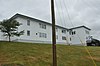 | |
| Building 311 | Former Pepperrell AFB St. John's NL | 47°35′06″N 52°41′54″W / 47.5849°N 52.6983°W / 47.5849; -52.6983 (Building 311) | Federal (11443) |  | |
| Building 312 | Former Pepperrell AFB St. John's NL | 47°35′06″N 52°41′50″W / 47.585°N 52.6972°W / 47.585; -52.6972 (Building 312) | Federal (11445) | 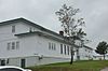 | |
| Building 313 | Former Pepperrell AFB St. John's NL | 47°35′05″N 52°41′58″W / 47.5847°N 52.6995°W / 47.5847; -52.6995 (Building 313) | Federal (11446) | 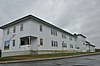 | |
| Building 314 | Former Pepperrell AFB St. John's NL | 47°35′06″N 52°41′39″W / 47.585°N 52.6943°W / 47.585; -52.6943 (Building 314) | Federal (11448) |  | |
| Building 401 | Former Pepperrell AFB St. John's NL | 47°35′07″N 52°41′46″W / 47.5852°N 52.6962°W / 47.5852; -52.6962 (Building 401) | Federal (11366) |  | |
| Building 402 | Former Pepperrell AFB St. John's NL | 47°35′07″N 52°41′46″W / 47.5854°N 52.696°W / 47.5854; -52.696 (Building 402) | Federal (11368) |  | |
| Building 403 | Former Pepperrell AFB St. John's NL | 47°35′09″N 52°41′47″W / 47.5857°N 52.6963°W / 47.5857; -52.6963 (Building 403) | Federal (11373) |  | |
| Building 404 | Former Pepperrell AFB St. John's NL | 47°35′09″N 52°41′48″W / 47.5859°N 52.6967°W / 47.5859; -52.6967 (Building 404) | Federal (11376) |  | |
| Building 405 | Former Pepperrell AFB St. John's NL | 47°35′07″N 52°41′48″W / 47.5854°N 52.6968°W / 47.5854; -52.6968 (Building 405) | Federal (11378) | 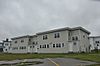 | |
| Building 406 | Former Pepperrell AFB St. John's NL | 47°35′08″N 52°41′50″W / 47.5855°N 52.6972°W / 47.5855; -52.6972 (Building 406) | Federal (11380) | 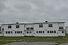 | |
| Building 407 | Former Pepperrell AFB St. John's NL | 47°35′06″N 52°41′39″W / 47.585°N 52.6943°W / 47.585; -52.6943 (Building 407) | Federal (7492) | 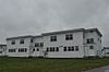 | |
| Building 408 | Former Pepperrell AFB St. John's NL | 47°35′06″N 52°41′39″W / 47.585°N 52.6943°W / 47.585; -52.6943 (Building 408) | Federal (7493) | 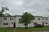 | |
| Building 409 | Former Pepperrell AFB St. John's NL | 47°35′10″N 52°41′52″W / 47.586°N 52.6977°W / 47.586; -52.6977 (Building 409) | Federal (11423) | 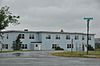 | |
| Building 410 | Former Pepperrell AFB St. John's NL | 47°35′09″N 52°41′54″W / 47.5858°N 52.6982°W / 47.5858; -52.6982 (Building 410) | Federal (11426) |  | |
| Building 501 | Former Pepperrell AFB St. John's NL | 47°35′06″N 52°41′44″W / 47.5851°N 52.6955°W / 47.5851; -52.6955 (Building 501) | Federal (11427) | Upload Photo | |
| Building 507 | Former Pepperrell AFB St. John's NL | 47°35′10″N 52°41′42″W / 47.5862°N 52.6951°W / 47.5862; -52.6951 (Building 507) | Federal (11431) | Upload Photo | |
| Building 508 | Former Pepperrell AFB St. John's NL | 47°35′09″N 52°41′42″W / 47.5857°N 52.695°W / 47.5857; -52.695 (Building 508) | Federal (11432) | Upload Photo | |
| Building 509 | Former Pepperrell AFB St. John's NL | 47°35′07″N 52°41′42″W / 47.5852°N 52.6949°W / 47.5852; -52.6949 (Building 509) | Federal (11433) |  | |
| Building 511 | Former Pepperrell AFB St. John's NL | 47°35′09″N 52°41′40″W / 47.5858°N 52.6945°W / 47.5858; -52.6945 (Building 511) | Federal (11434) | Upload Photo | |
| Building 512 | Former Pepperrell AFB St. John's NL | 47°35′11″N 52°41′40″W / 47.5863°N 52.6945°W / 47.5863; -52.6945 (Building 512) | Federal (11436) | Upload Photo | |
| Building 517 | Former Pepperrell AFB St. John's NL | 47°35′12″N 52°41′37″W / 47.5867°N 52.6937°W / 47.5867; -52.6937 (Building 517) | Federal (11491) | Upload Photo | |
| Building 806 | Former Pepperrell AFB St. John's NL | 47°35′12″N 52°41′20″W / 47.5868°N 52.6888°W / 47.5868; -52.6888 (Building 806) | Federal (11381) |  | |
| Cabot Tower | Signal Hill Road St. John's NL | 47°34′23″N 52°40′58″W / 47.573°N 52.6829°W / 47.573; -52.6829 (Cabot Tower) | Federal (2974) | 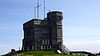 | |
| Canada House Municipal Heritage Building | 74 Circular Road St. John's NL | 47°34′19″N 52°42′48″W / 47.572°N 52.7132°W / 47.572; -52.7132 (Canada House Municipal Heritage Building) | St. John's municipality (10609) |  | |
| Cape Spear Lighthouse | Blackhead Road, Highway 11 St. John's NL | 47°31′20″N 52°37′29″W / 47.5223°N 52.6247°W / 47.5223; -52.6247 (Cape Spear Lighthouse) | Federal (2885, (7404), Newfoundland and Labrador (20775) | 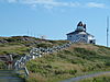 | |
| Chapel Hill Condominiums | 39 Queen's Road St. John's NL | 47°34′03″N 52°42′30″W / 47.5676°N 52.7082°W / 47.5676; -52.7082 (Chapel Hill Condominiums) | St. John's municipality (3302) | 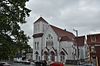 | |
| 24 Circular Road Municipal Heritage Building | 24 Circular Road St. John's NL | 47°34′27″N 52°42′24″W / 47.5741°N 52.7066°W / 47.5741; -52.7066 (24 Circular Road Municipal Heritage Building) | St. John's municipality (10389) | 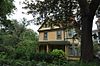 | |
| Cochrane Street United Church | Cochrane Street St. John's NL | 47°34′10″N 52°42′10″W / 47.5694°N 52.7027°W / 47.5694; -52.7027 (Cochrane Street United Church) | Newfoundland and Labrador (3054), St. John's municipality (5346) | 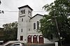 | |
| 028 Cochrane Street | 28 Cochrane Street St. John's NL | 47°34′10″N 52°42′10″W / 47.5694°N 52.7027°W / 47.5694; -52.7027 (28 Cochrane Street) | Newfoundland and Labrador (2278), St. John's municipality (10409) |  | |
| Colonial Building | Military Road St. John's NL | 47°34′15″N 52°42′23″W / 47.5709°N 52.7065°W / 47.5709; -52.7065 (Colonial Building) | Newfoundland and Labrador (3063) |  | |
| Commercial Cable Company Building | 95 Water Street St. John's NL | 47°34′00″N 52°42′14″W / 47.5666°N 52.704°W / 47.5666; -52.704 (Commercial Cable Company Building) | Newfoundland and Labrador (2112) |  | |
| Christ Church / Quidi Vidi Church National Historic Site of Canada | 100 The Boulevard St. John's NL | 47°34′58″N 52°41′33″W / 47.5828°N 52.6924°W / 47.5828; -52.6924 (Christ Church / Quidi Vidi Church National Historic Site of Canada) | Federal (11958), Newfoundland and Labrador (5274) |  | |
| Church of England Institute CEI Club | corner of Hamilton Avenue and Sudbury Street St. John's NL | 47°33′09″N 52°43′17″W / 47.5526°N 52.7215°W / 47.5526; -52.7215 (Church of England Institute CEI Club) | St. John's municipality (2087) |  | |
| 034 Circular Road Municipal Heritage Building | 34 Circular Road St. John's NL | 47°34′25″N 52°42′29″W / 47.5737°N 52.708°W / 47.5737; -52.708 (34 Circular Road Municipal Heritage Building) | St. John's municipality (5538) |  | |
| Commercial Chambers Building | 197 Water Street St. John's NL | 47°33′50″N 52°42′25″W / 47.5638°N 52.707°W / 47.5638; -52.707 (Commercial Chambers Building) | Newfoundland and Labrador (2149) | | |
| Cornerstone Theatre | corner of Queen, George and Water Streets St. John's NL | 47°33′37″N 52°42′43″W / 47.5604°N 52.712°W / 47.5604; -52.712 (Cornerstone Theatre) | St. John's municipality (2643) | Upload Photo | |
| Crow's Nest Officer's Club | Water Street St. John's NL | 47°34′01″N 52°42′13″W / 47.5669°N 52.7036°W / 47.5669; -52.7036 (Crow's Nest Officer's Club) | Federal (18926), Newfoundland and Labrador (2279) |  | |
| The Deanery (Anglican Cathedral Parish Rectory) | 22 Church Hill St. John's NL | 47°33′57″N 52°42′32″W / 47.5657°N 52.7088°W / 47.5657; -52.7088 (The Deanery (Anglican Cathedral Parish Rectory)) | St. John's municipality (2613) |  | |
| Delgado Building Municipal Heritage Building | 169-173 Water Street St. John's NL | 47°33′54″N 52°42′22″W / 47.5649°N 52.706°W / 47.5649; -52.706 (Delgado Building Municipal Heritage Building) | St. John's municipality (5537) |  | |
| Devon House Registered Heritage Structure | 59 Duckworth Street St. John's NL | 47°34′14″N 52°41′59″W / 47.5705°N 52.6996°W / 47.5705; -52.6996 (Devon House Registered Heritage Structure) | Newfoundland and Labrador (2283) | 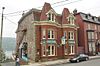 | |
| Devon Place | 3 Forest Road St. John's NL | 47°34′20″N 52°42′53″W / 47.5723°N 52.7146°W / 47.5723; -52.7146 (Devon Place) | Newfoundland and Labrador (3306) | 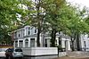 | |
| Devon Row Municipal Heritage Building | 1-4 Devon Row (Duckworth Street) St. John's NL | 47°34′14″N 52°41′59″W / 47.5706°N 52.6998°W / 47.5706; -52.6998 (Devon Row Municipal Heritage Building) | St. John's municipality (10419) | 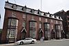 | |
| 261 Duckworth Street | 261 Duckworth Street St. John's NL | 47°33′58″N 52°42′21″W / 47.566°N 52.7057°W / 47.566; -52.7057 (261 Duckworth Street) | St. John's municipality (2637) | 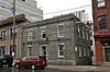 | |
| 271-275 Duckworth Street | 271-275 Duckworth Street St. John's NL | 47°33′56″N 52°42′22″W / 47.5656°N 52.7062°W / 47.5656; -52.7062 (271-275 Duckworth Street) | St. John's municipality (2495) | 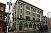 | |
| 333 Duckworth Street | 333 Duckworth Street St. John's NL | 47°33′50″N 52°42′28″W / 47.5639°N 52.7079°W / 47.5639; -52.7079 (333 Duckworth Street) | St. John's municipality (3426) |  | |
| 377 Duckworth Street | 377 Duckworth Street St. John's NL | 47°33′46″N 52°42′40″W / 47.5627°N 52.7112°W / 47.5627; -52.7112 (377 Duckworth Street) | Newfoundland and Labrador (2284) |  | |
| Elizabeth Manor Municipal Heritage Building | 21 Military Road St. John's NL | 47°34′16″N 52°42′12″W / 47.5712°N 52.7032°W / 47.5712; -52.7032 (Elizabeth Manor Municipal Heritage Building) | St. John's municipality (5542) |  | |
| Emmanuel House Municipal Heritage Building | 83 Cochrane Street St. John's NL | 47°34′16″N 52°42′16″W / 47.571°N 52.7045°W / 47.571; -52.7045 (Emmanuel House Municipal Heritage Building) | St. John's municipality (6128) |  | |
| Forest House | 50 Forest Road St. John's NL | 47°34′29″N 52°42′10″W / 47.5747°N 52.7027°W / 47.5747; -52.7027 (Forest House) | Newfoundland and Labrador (2305), St. John's municipality (5343) | 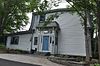 | |
| Former Bank of British North America National Historic Site of Canada | 276 Duckworth Street St. John's NL | 47°33′57″N 52°42′23″W / 47.5658°N 52.7063°W / 47.5658; -52.7063 (Former Bank of British North America National Historic Site of Canada) | Federal (12643), Newfoundland and Labrador (2329), St. John's municipality (10478) | 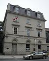 | |
| Former Newfoundland Railway Terminus & Headquarters | 495 Water Street St. John's NL | 47°33′17″N 52°42′49″W / 47.5546°N 52.7135°W / 47.5546; -52.7135 (Former Newfoundland Railway Terminus & Headquarters) | Federal (6501, (15725) |  | |
| Fort Amherst National Historic Site of Canada | Southside Road St. John's NL | 47°33′49″N 52°40′48″W / 47.5636°N 52.6799°W / 47.5636; -52.6799 (Fort Amherst National Historic Site of Canada) | Federal (12850) |  | |
| Fort Townshend National Historic Site of Canada | Bonaventure Avenue and Harvey Roads St. John's NL | 47°33′58″N 52°42′44″W / 47.5662°N 52.7121°W / 47.5662; -52.7121 (Fort Townshend National Historic Site of Canada) | Federal (14342) | 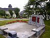 | |
| Fort William National Historic Site of Canada | 115 Cavendish Square (plaque) St. John's NL | 47°34′15″N 52°42′03″W / 47.5709°N 52.7008°W / 47.5709; -52.7008 (Fort William National Historic Site of Canada) | Federal (13082) | Upload Photo | |
| George Street United Church Municipal Heritage Building | George Street St. John's NL | 47°33′29″N 52°42′48″W / 47.558°N 52.7132°W / 47.558; -52.7132 (George Street United Church Municipal Heritage Building) | Newfoundland and Labrador (2315), St. John's municipality (10485) | 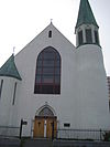 | |
| Government House National Historic Site of Canada | 80 Military Road St. John's NL | 47°34′20″N 52°42′18″W / 47.5722°N 52.7051°W / 47.5722; -52.7051 (Government House National Historic Site of Canada) | Federal (13399) |  | |
| Gower Street United Church | Queen's Road St. John's NL | 47°33′58″N 52°42′38″W / 47.5662°N 52.7105°W / 47.5662; -52.7105 (Gower Street United Church) | Newfoundland and Labrador (2285) | 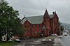 | |
| 018 Gower Street Municipal Heritage Building | 18 Gower Street St. John's NL | 47°34′13″N 52°42′10″W / 47.5704°N 52.7027°W / 47.5704; -52.7027 (18 Gower Street Municipal Heritage Building) | St. John's municipality (5352) |  | |
| 020 Gower Street Municipal Heritage Building | 20 Gower Street St. John's NL | 47°34′13″N 52°42′10″W / 47.5704°N 52.7027°W / 47.5704; -52.7027 (20 Gower Street Municipal Heritage Building) | St. John's municipality (5353) | 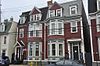 | |
| 022 Gower Street Municipal Heritage Building | 22 Gower Street St. John's NL | 47°34′13″N 52°42′10″W / 47.5704°N 52.7029°W / 47.5704; -52.7029 (22 Gower Street Municipal Heritage Building) | St. John's municipality (5354) | | |
| Grace Building, 283-285 Water Street Municipal Heritage Building | 283-285 Water Street St. John's NL | 47°33′44″N 52°42′32″W / 47.5621°N 52.709°W / 47.5621; -52.709 (Grace Building, 283-285 Water Street Municipal Heritage Building) | St. John's municipality (5850) |  | |
| Harris Cottage | 43 Monkstown Road St. John's NL | 47°34′13″N 52°42′38″W / 47.5702°N 52.7105°W / 47.5702; -52.7105 (Harris Cottage) | Newfoundland and Labrador (2286), St. John's municipality (10502) |  | |
| Horwood House | 718 Water Street St. John's NL | 47°32′57″N 52°43′17″W / 47.5493°N 52.7214°W / 47.5493; -52.7214 (Horwood House) | Newfoundland and Labrador (2287) |  | |
| The House | 21 Rennie's Mill Road St. John's NL | 47°34′11″N 52°42′36″W / 47.5698°N 52.71°W / 47.5698; -52.71 (The House) | Newfoundland and Labrador (2624) |  | |
| Howard House Municipal Heritage Building | 7 Garrison Hill St. John's NL | 47°34′00″N 52°42′33″W / 47.5666°N 52.7091°W / 47.5666; -52.7091 (Howard House Municipal Heritage Building) | Newfoundland and Labrador (2314), St. John's municipality (10483) |  | |
| The Imperial | 22 Flavin Street (corner of Bond) St. John's NL | 47°34′07″N 52°42′21″W / 47.5686°N 52.7057°W / 47.5686; -52.7057 (The Imperial) | St. John's municipality (3363) |  | |
| Kelvin House and Conservatory Registered Heritage Structure | 49 Rennie's Mill Road St. John's NL | 47°34′15″N 52°42′38″W / 47.5709°N 52.7105°W / 47.5709; -52.7105 (Kelvin House and Conservatory Registered Heritage Structure) | Newfoundland and Labrador (2619), St. John's municipality (5451) | 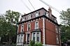 | |
| King George V Building | 93 Water Street, diagonally across from War Memorial St. John's NL | 47°34′01″N 52°42′13″W / 47.5669°N 52.7036°W / 47.5669; -52.7036 (King George V Building) | St. John's municipality (1134) | 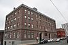 | |
| 031 King's Bridge Road | 31 King's Bridge Road St. John's NL | 47°34′30″N 52°42′12″W / 47.5749°N 52.7032°W / 47.5749; -52.7032 (031 King's Bridge Road) | St. John's municipality (3299) | 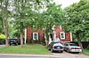 | |
| 033 King's Bridge Road | 33 King's Bridge Road St. John's NL | 47°34′29″N 52°42′12″W / 47.5747°N 52.7032°W / 47.5747; -52.7032 (33 King's Bridge Road) | St. John's municipality (3425) | | |
| 035 King's Bridge Road Municipal Heritage Building | 35 King's Bridge Road St. John's NL | 47°34′31″N 52°42′12″W / 47.5753°N 52.7033°W / 47.5753; -52.7033 (35 King's Bridge Road Municipal Heritage Building) | St. John's municipality (5539) |  | |
| Kinkora | 36 King's Bridge Road St. John's NL | 47°34′30″N 52°42′09″W / 47.5749°N 52.7025°W / 47.5749; -52.7025 (Kinkora) | St. John's municipality (2638) | 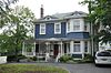 | |
| Lakecrest Independent School | 58 Patrick Street St. John's NL | 47°33′14″N 52°43′02″W / 47.554°N 52.7173°W / 47.554; -52.7173 (Lakecrest Independent School) | St. John's municipality (3178) | 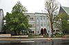 | |
| The Lea | 39 Topsail Road St. John's NL | 47°32′44″N 52°43′25″W / 47.5455°N 52.7236°W / 47.5455; -52.7236 (The Lea) | Newfoundland and Labrador (2167) | 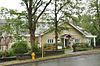 | |
| Longshoremen's Protective Union (LSPU) Hall | 3 Victoria Street St. John's NL | 47°33′58″N 52°42′23″W / 47.5661°N 52.7065°W / 47.5661; -52.7065 (Longshoremen's Protective Union (LSPU) Hall) | Newfoundland and Labrador (2152) | 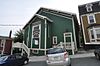 | |
| Majestic Theatre Municipal Heritage Building | 390 Duckworth Street St. John's NL | 47°33′45″N 52°42′39″W / 47.5624°N 52.7107°W / 47.5624; -52.7107 (Majestic Theatre Municipal Heritage Building) | St. John's municipality (5536) | 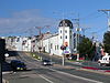 | |
| Mallard Cottage | 2 Barrows Road St. John's NL | 47°34′19″N 52°41′51″W / 47.572°N 52.6976°W / 47.572; -52.6976 (Mallard Cottage) | Federal (4226), Newfoundland and Labrador (2150), St. John's municipality (10380) | 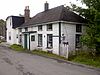 | |
| Martin McNamara House | 15 Plank Road St. John's NL | 47°33′14″N 52°42′54″W / 47.554°N 52.7151°W / 47.554; -52.7151 (Martin McNamara House) | Newfoundland and Labrador (2321), St. John's municipality (10506) | Upload Photo | |
| Military Hospital | Forest Road St. John's NL | 47°34′31″N 52°41′40″W / 47.5753°N 52.6944°W / 47.5753; -52.6944 (Military Hospital) | St. John's municipality (2430) | Upload Photo | |
| 112 Military Road Municipal Heritage Building | 112 Military Road St. John's NL | 47°34′11″N 52°42′27″W / 47.5698°N 52.7076°W / 47.5698; -52.7076 (112 Military Road Municipal Heritage Building) | St. John's municipality (2717) |  | |
| The Monastery (Old St. Bonaventure's College) | Bonaventure Avenue (attached to Bishop's Library and St. Bonaventure's College) St. John's NL | 47°34′03″N 52°42′46″W / 47.5675°N 52.7127°W / 47.5675; -52.7127 (The Monastery (Old St. Bonaventure's College)) | Newfoundland and Labrador (2623) | 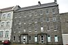 | |
| Monkstown Manor | 51 Monkstown Road St. John's NL | 47°34′13″N 52°42′39″W / 47.5704°N 52.7109°W / 47.5704; -52.7109 (Monkstown Manor) | St. John's municipality (2639) |  | |
| 007 Monkstown Road | 7 Monkstown Road St. John's NL | 47°34′08″N 52°42′32″W / 47.569°N 52.7089°W / 47.569; -52.7089 (7 Monkstown Road) | Newfoundland and Labrador (2718), St. John's municipality (10503) |  | |
| Mount St. Francis Monastery | Merrymeeting Road St. John's NL | 47°34′02″N 52°42′52″W / 47.5672°N 52.7144°W / 47.5672; -52.7144 (Mount St. Francis Monastery) | Newfoundland and Labrador (2113), St. John's municipality (10490) |  | |
| Murray Premises | 5 Beck's Cove St. John's NL | 47°33′41″N 52°42′34″W / 47.5614°N 52.7094°W / 47.5614; -52.7094 (Murray Premises) | Federal (12929), St. John's municipality (2232) |  | |
| The New House, 335 Southside Road | 335 Southside Road St. John's NL | 47°33′04″N 52°42′58″W / 47.551°N 52.7161°W / 47.551; -52.7161 (The New House, 335 Southside Road) | Newfoundland and Labrador (2621) |  | |
| The New House, 337 Southside Road | 337 Southside Road St. John's NL | 47°33′00″N 52°42′58″W / 47.550°N 52.7162°W / 47.550; -52.7162 (The New House, 337 Southside Road) | Newfoundland and Labrador (2620) | | |
| Newman Building | 1 Springdale Street St. John's NL | 47°33′26″N 52°42′44″W / 47.5572°N 52.7123°W / 47.5572; -52.7123 (Newman Building) | St. John's municipality (2644) |  | |
| Newman Wine Vaults Provincial Historic Site | 436 Water Street St. John's NL | 47°33′26″N 52°42′44″W / 47.5571°N 52.7123°W / 47.5571; -52.7123 (Newman Wine Vaults Provincial Historic Site) | Newfoundland and Labrador (2153) |  | |
| The Observatory Municipal Heritage Building | 1 Bonaventure Avenue St. John's NL | 47°34′00″N 52°42′39″W / 47.5666°N 52.7108°W / 47.5666; -52.7108 (The Observatory Municipal Heritage Building) | St. John's municipality (10379) |  | |
| O'Donel Memorial Hall | 58 Queen's Road and 189 Military Road St. John's NL | 47°34′01″N 52°42′34″W / 47.5669°N 52.7094°W / 47.5669; -52.7094 (O'Donel Memorial Hall) | St. John's municipality (4071) | 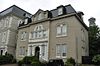 | |
| O'Dwyer Block | Water Street St. John's NL | 47°33′42″N 52°42′35″W / 47.5618°N 52.7096°W / 47.5618; -52.7096 (O'Dwyer Block) | Newfoundland and Labrador (2154) |  | |
| The Old London, New York and Paris Building | 179-181 Water Street, corner of Baird's Cove St. John's NL | 47°33′53″N 52°42′22″W / 47.5647°N 52.7062°W / 47.5647; -52.7062 (The Old London, New York and Paris Building) | St. John's municipality (2083) | 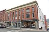 | |
| Oratory of the Sacred Heart, Our Lady of Mercy Convent | Military Road St. John's NL | 47°34′04″N 52°42′39″W / 47.5677°N 52.7109°W / 47.5677; -52.7109 (Oratory of the Sacred Heart, Our Lady of Mercy Convent) | Newfoundland and Labrador (2288) | Upload Photo | |
| Our Lady of Mercy Convent | Military Road St. John's NL | 47°34′05″N 52°42′40″W / 47.5681°N 52.711°W / 47.5681; -52.711 (Our Lady of Mercy Convent) | Newfoundland and Labrador (2173) | Upload Photo | |
| 003 Park Place | 3 Park Place St. John's NL | 47°34′13″N 52°42′33″W / 47.5702°N 52.7092°W / 47.5702; -52.7092 (3 Park Place) | Newfoundland and Labrador (3304), St. John's municipality (10504) |  | |
| 004 Park Place | 4 Park Place St. John's NL | 47°34′13″N 52°42′33″W / 47.5703°N 52.7091°W / 47.5703; -52.7091 (4 Park Place) | St. John's municipality (2641) |  | |
| Peppercorn House Municipal Heritage Building | 25 Monkstown Road St. John's NL | 47°34′10″N 52°42′35″W / 47.5695°N 52.7098°W / 47.5695; -52.7098 (Peppercorn House Municipal Heritage Building) | St. John's municipality (5543) |  | |
| 007 Plank Road | 7 Plank Road St. John's NL | 47°33′16″N 52°42′54″W / 47.5545°N 52.7151°W / 47.5545; -52.7151 (7 Plank Road) | St. John's municipality (3839) | Upload Photo | |
| Pleasantville-Building 223 | 2231 Legion Street St. John's NL | 47°35′06″N 52°41′39″W / 47.585°N 52.6943°W / 47.585; -52.6943 (Pleasantville-Building 223) | Federal (7590) |  | |
| 015 Portugal Cove Road | 15 Portugal Cove Road St. John's NL | 47°34′35″N 52°42′36″W / 47.5765°N 52.71°W / 47.5765; -52.71 (15 Portugal Cove Road) | St. John's municipality (3179) | Upload Photo | |
| 074-076 Prescott Street | 74-76 Prescott Street St. John's NL | 47°34′06″N 52°42′26″W / 47.5684°N 52.7072°W / 47.5684; -52.7072 (74-76 Prescott Street) | St. John's municipality (3180) | 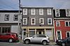 | |
| 078 Prescott Street, Neville Framing | 78 Prescott Street St. John's NL | 47°34′06″N 52°42′26″W / 47.5684°N 52.7072°W / 47.5684; -52.7072 (78 Prescott Street, Neville Framing) | St. John's municipality (3181) |  | |
| Presentation Convent and School | Cathedral Square St. John's NL | 47°34′05″N 52°42′40″W / 47.5681°N 52.711°W / 47.5681; -52.711 (Presentation Convent and School) | Newfoundland and Labrador (2290) |  | |
| Provincial Museum of Newfoundland and Labrador | 285 Duckworth Street St. John's NL | 47°33′54″N 52°42′24″W / 47.5651°N 52.7067°W / 47.5651; -52.7067 (Provincial Museum of Newfoundland and Labrador) | St. John's municipality (2331) | 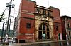 | |
| Queen Victoria Wing | Forest Road St. John's NL | 47°34′31″N 52°41′40″W / 47.5753°N 52.6944°W / 47.5753; -52.6944 (Queen Victoria Wing) | St. John's municipality (2431) | Upload Photo | |
| 30 Queen's Road | 30 Queen's Road St. John's NL | 47°34′06″N 52°42′30″W / 47.5682°N 52.7084°W / 47.5682; -52.7084 (30 Queen's Road) | St. John's municipality (3301) |  | |
| 32 Queen's Road Municipal Heritage Building | 32 Queen's Road St. John's NL | 47°34′05″N 52°42′34″W / 47.5681°N 52.7094°W / 47.5681; -52.7094 (32 Queen's Road Municipal Heritage Building) | St. John's municipality (12063) |  | |
| 034 Queen's Road | 34 Queen's Road St. John's NL | 47°34′05″N 52°42′34″W / 47.5681°N 52.7094°W / 47.5681; -52.7094 (34 Queen's Road) | Newfoundland and Labrador (2561) |  | |
| Quidi Vidi Battery | Cuckhold's Cove Road St. John's NL | 47°34′49″N 52°40′29″W / 47.5804°N 52.6748°W / 47.5804; -52.6748 (Quidi Vidi Battery) | Newfoundland and Labrador (3061) | 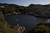 | |
| Rennie's Mill Road Historic District National Historic Site of Canada | 21-79,12-54 Rennie's Mill Road St. John's NL | 47°34′16″N 52°42′34″W / 47.571°N 52.7095°W / 47.571; -52.7095 (Rennie's Mill Road Historic District National Historic Site of Canada) | Federal (10699) |  | |
| Retreat Cottage | 14 Kenna's Hill St. John's NL | 47°34′45″N 52°42′14″W / 47.5792°N 52.704°W / 47.5792; -52.704 (Retreat Cottage) | Newfoundland and Labrador (2302) |  | |
| Richmond Hill | 18 Topsail Road St. John's NL | 47°32′49″N 52°43′25″W / 47.547°N 52.7236°W / 47.547; -52.7236 (Richmond Hill) | St. John's municipality (2719) |  | |
| Ruby Church | Main Road St. John's NL | 47°29′08″N 52°46′05″W / 47.4855°N 52.7681°W / 47.4855; -52.7681 (Ruby Church) | Newfoundland and Labrador (2194) | 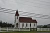 | |
| S.O. Steele Building | 100 Water Street St. John's NL | 47°34′02″N 52°42′14″W / 47.5672°N 52.704°W / 47.5672; -52.704 (S.O. Steele Building) | Newfoundland and Labrador (2160) |  | |
| St. Andrew's Church (The Kirk) | above Queen's Road at Long's Hill St. John's NL | 47°33′56″N 52°42′39″W / 47.5655°N 52.7109°W / 47.5655; -52.7109 (St. Andrew's Church (The Kirk)) | Newfoundland and Labrador (2162) | Upload Photo | |
| St. Bonaventure's College (Mullock Hall) Registered Heritage Structure | Bonaventure Avenue St. John's NL | 47°34′03″N 52°42′46″W / 47.5675°N 52.7127°W / 47.5675; -52.7127 (St. Bonaventure's College (Mullock Hall) Registered Heritage Structure) | Newfoundland and Labrador (2622) |  | |
| St. John the Baptist Anglican Cathedral National Historic Site of Canada | 18 Church Hill St. John's NL | 47°33′55″N 52°42′31″W / 47.5652°N 52.7085°W / 47.5652; -52.7085 (St. John the Baptist Anglican Cathedral National Historic Site of Canada) | Federal (12663), Newfoundland and Labrador (5113), St. John's municipality (8063) |  | |
| St. John's Court House National Historic Site of Canada | 194 Water Street St. John's NL | 47°33′50″N 52°42′22″W / 47.564°N 52.7061°W / 47.564; -52.7061 (St. John's Court House National Historic Site of Canada) | Federal (2923), St. John's municipality (2107) |  | |
| St. John's Ecclesiastical District | roughly properties on Cathedral Street, Bonaventure Avenue, Church Hill, and adjacent St. John's NL | 47°34′05″N 52°42′40″W / 47.5681°N 52.711°W / 47.5681; -52.711 (St. John's Ecclesiastical District) | St. John's municipality (4039) |  | |
| St. John's Masonic Temple | 6 Cathedral Street St. John's NL | 47°33′57″N 52°42′27″W / 47.5658°N 52.7074°W / 47.5658; -52.7074 (St. John's Masonic Temple) | Newfoundland and Labrador (2151), St. John's municipality (5300) |  | |
| St. Joseph's Chapel | Blackhead neighborhood St. John's NL | 47°31′23″N 52°39′35″W / 47.5231°N 52.6596°W / 47.5231; -52.6596 (St. Joseph's Chapel) | Newfoundland and Labrador (2163), St. John's municipality (5271) |  | |
| St. Michael's Convent, Belvedere | Bonaventure Avenue St. John's NL | 47°34′09″N 52°43′11″W / 47.5691°N 52.7197°W / 47.5691; -52.7197 (St. Michael's Convent, Belvedere) | Newfoundland and Labrador (2157), St. John's municipality (10489) | Upload Photo | |
| St. Michael's Orphanage, Belvedere | Bonaventure Avenue St. John's NL | 47°34′10″N 52°43′08″W / 47.5695°N 52.7189°W / 47.5695; -52.7189 (St. Michael's Orphanage, Belvedere) | Newfoundland and Labrador (2332), St. John's municipality (10488) | Upload Photo | |
| St. Patrick's Convent and School | 15 Convent Square St. John's NL | 47°33′14″N 52°42′59″W / 47.5539°N 52.7165°W / 47.5539; -52.7165 (St. Patrick's Convent and School) | St. John's municipality (2614) |  | |
| St. Patrick's Deanery Registered Heritage Structure | 6 Patrick Street St. John's NL | 47°33′12″N 52°42′58″W / 47.5534°N 52.7161°W / 47.5534; -52.7161 (St. Patrick's Deanery Registered Heritage Structure) | Newfoundland and Labrador (10849), St. John's municipality (2642) |  | |
| St. Patrick's Roman Catholic Church National Historic Site of Canada | 40 Patrick Street St. John's NL | 47°33′13″N 52°43′02″W / 47.5537°N 52.7171°W / 47.5537; -52.7171 (St. Patrick's Roman Catholic Church National Historic Site of Canada) | Federal (12845), Newfoundland and Labrador (2164), St. John's municipality (10505) |  | |
| St. Thomas' Church | 8 Military Road St. John's NL | 47°34′16″N 52°42′09″W / 47.5711°N 52.7026°W / 47.5711; -52.7026 (St. Thomas' Church) | Newfoundland and Labrador (2166), St. John's municipality (10492) |  | |
| St. Thomas Rectory / Commissariat House and Garden National Historic Site of Canada | King's Bridge Road St. John's NL | 47°34′21″N 52°42′09″W / 47.5725°N 52.7026°W / 47.5725; -52.7026 (St. Thomas Rectory / Commissariat House and Garden National Historic Site of Canada) | Federal (15612), Newfoundland and Labrador (3062) |  | |
| Signal Hill National Historic Site of Canada | Signal Hill Road and the south side of The Narrows St. John's NL | 47°34′21″N 52°40′55″W / 47.5724°N 52.682°W / 47.5724; -52.682 (Signal Hill National Historic Site of Canada) | Federal (4439) |  | |
| Squires Barn and Carriage House | 315-317 Mount Scio Road St. John's NL | 47°34′15″N 52°45′35″W / 47.5707°N 52.7598°W / 47.5707; -52.7598 (Squires Barn and Carriage House) | Newfoundland and Labrador (2293), St. John's municipality (8369) | Upload Photo | |
| Star of the Sea Hall Municipal Heritage Building | 40 Henry Street St. John's NL | 47°33′48″N 52°42′35″W / 47.5633°N 52.7097°W / 47.5633; -52.7097 (Star of the Sea Hall Municipal Heritage Building) | St. John's municipality (2082) | Upload Photo | |
| The Stone House | 8 Kenna's Hill St. John's NL | 47°34′43″N 52°42′14″W / 47.5786°N 52.7039°W / 47.5786; -52.7039 (The Stone House) | St. John's municipality (3177) |  | |
| Sunnyside Gatehouse Municipal Heritage Building | 60 Circular Road St. John's NL | 47°34′21″N 52°42′39″W / 47.5726°N 52.7109°W / 47.5726; -52.7109 (Sunnyside Gatehouse Municipal Heritage Building) | St. John's municipality (5453) |  | |
| Sunnyside House Registered Heritage Structure | 70 Circular Road St. John's NL | 47°34′20″N 52°42′46″W / 47.5723°N 52.7129°W / 47.5723; -52.7129 (Sunnyside House Registered Heritage Structure) | Newfoundland and Labrador (8061), St. John's municipality (5454) |  | |
| Sutherland Place | 10-20 King's Bridge Road St. John's NL | 47°34′11″N 52°42′27″W / 47.5698°N 52.7076°W / 47.5698; -52.7076 (Sutherland Place) | St. John's municipality (4043) |  | |
| Temperance Street Houses Registered Heritage Structure (Four Sisters) | 31, 33, 35, and 37 Temperance Street St. John's NL | 47°34′16″N 52°41′52″W / 47.5712°N 52.6978°W / 47.5712; -52.6978 (Temperance Street Houses Registered Heritage Structure (Four Sisters)) | Newfoundland and Labrador (10692), St. John's municipality (12901) |  | |
| Thimble Cottage Registered Heritage Structure | 150 Oxen Pond Road St. John's NL | 47°33′57″N 52°45′21″W / 47.5659°N 52.7557°W / 47.5659; -52.7557 (Thimble Cottage Registered Heritage Structure) | Newfoundland and Labrador (2625), St. John's municipality (8370) |  | |
| Thompson Building | 303-305 Water Street St. John's NL | 47°33′42″N 52°42′35″W / 47.5618°N 52.7096°W / 47.5618; -52.7096 (Thompson Building) | Newfoundland and Labrador (2168) |  | |
| Tobin Building | 214 Duckworth Street St. John's NL | 47°34′03″N 52°42′16″W / 47.5675°N 52.7045°W / 47.5675; -52.7045 (Tobin Building) | Newfoundland and Labrador (2294), St. John's municipality (10420) |  | |
| Union Bank Building | 287 Duckworth Street St. John's NL | 47°33′54″N 52°42′25″W / 47.565°N 52.7069°W / 47.565; -52.7069 (Union Bank Building) | St. John's municipality (2515) |  | |
| 027 Victoria Street | 27 Victoria Street St. John's NL | 47°34′00″N 52°42′28″W / 47.5667°N 52.7078°W / 47.5667; -52.7078 (27 Victoria Street) | St. John's municipality (3364) |  | |
| Water Street Historic District National Historic Site of Canada | 288-300 and 291-307 Water Street as well as the Murray Premises National Historic Site St. John's NL | 47°33′42″N 52°42′36″W / 47.5617°N 52.7101°W / 47.5617; -52.7101 (Water Street Historic District National Historic Site of Canada) | Federal (7700) |  | |
| 73, 75 and 77 Water Street Registered Heritage Structure | 73, 75, and 77 Water Street St. John's NL | 47°34′04″N 52°42′11″W / 47.5679°N 52.703°W / 47.5679; -52.703 (73, 75 and 77 Water Street Registered Heritage Structure) | Newfoundland and Labrador (10847) |  | |
| 187-189 Water Street | 187-189 Water Street St. John's NL | 47°33′49″N 52°42′25″W / 47.5636°N 52.7069°W / 47.5636; -52.7069 (187-189 Water Street) | St. John's municipality (2720) |  | |
| 191 Water Street | 191 Water Street St. John's NL | 47°33′50″N 52°42′25″W / 47.5638°N 52.7069°W / 47.5638; -52.7069 (191 Water Street) | St. John's municipality (2721) |  | |
| 193 Water Street | 193 Water Street St. John's NL | 47°33′50″N 52°42′25″W / 47.5639°N 52.7069°W / 47.5639; -52.7069 (193 Water Street) | St. John's municipality (2722) |  | |
| 201 Water Street Municipal Heritage Building | 201 Water Street St. John's NL | 47°33′50″N 52°42′25″W / 47.5639°N 52.7070°W / 47.5639; -52.7070 (201 Water Street Municipal Heritage Building) | St. John's municipality (5535) |  | |
| 203 Water Street Municipal Heritage Building | 203 Water Street St. John's NL | 47°33′50″N 52°42′27″W / 47.5639°N 52.7075°W / 47.5639; -52.7075 (203 Water Street Municipal Heritage Building) | St. John's municipality (5587) |  | |
| 205 Water Street Municipal Heritage Building | 205 Water Street St. John's NL | 47°33′50″N 52°42′28″W / 47.5639°N 52.7077°W / 47.5639; -52.7077 (205 Water Street Municipal Heritage Building) | St. John's municipality (6129) |  | |
| 226 Water Street Municipal Heritage Building | 226 Water Street St. John's NL | 47°33′49″N 52°42′29″W / 47.5635°N 52.708°W / 47.5635; -52.708 (226 Water Street Municipal Heritage Building) | St. John's municipality (6133) |  | |
| 562-564 Water Street | 562-564 Water Street St. John's NL | 47°33′16″N 52°42′48″W / 47.5545°N 52.7134°W / 47.5545; -52.7134 (562-564 Water Street) | Newfoundland and Labrador (2295) |  | |
| Waterford Hall | 185 Waterford Bridge Road St. John's NL | 47°32′06″N 52°44′10″W / 47.5349°N 52.7361°W / 47.5349; -52.7361 (Waterford Hall) | Newfoundland and Labrador (2169) |  | |
| Wesley United Church | 101 Patrick Street St. John's NL | 47°33′16″N 52°43′10″W / 47.5544°N 52.7194°W / 47.5544; -52.7194 (Wesley United Church) | St. John's municipality (3300) |  | |
| Winterholme National Historic Site of Canada | 79 Rennies Mill Road St. John's NL | 47°34′21″N 52°42′37″W / 47.5724°N 52.7103°W / 47.5724; -52.7103 (Winterholme National Historic Site of Canada) | Federal (2914), Newfoundland and Labrador (5093) |  | |
| Yellow Belly Corner Municipal Heritage Building | corner of Water Street, Beck's Cove and George Street St. John's NL | 47°33′44″N 52°42′36″W / 47.5621°N 52.7099°W / 47.5621; -52.7099 (Yellow Belly Corner Municipal Heritage Building) | Newfoundland and Labrador (5341), St. John's municipality (1201) |  |
See also
- List of historic places on the Avalon Peninsula
- List of historic places in Newfoundland and Labrador
- List of National Historic Sites of Canada in Newfoundland and Labrador
- v
- t
- e
- Cape Spear Lighthouse
- Castle Hill
- Hawthorne Cottage
- Hopedale Mission
- Kitjigattalik - Ramah Chert Quarries
- L'Anse aux Meadows
- Port au Choix
- Ryan Premises
- Signal Hill
- more...
Ecological Reserves
 Category
- St. John's geography
 Commons


