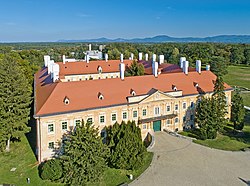
Malacky District
You can help expand this article with text translated from the corresponding article in German. (November 2017) Click [show] for important translation instructions.
- View a machine-translated version of the German article.
- Machine translation, like DeepL or Google Translate, is a useful starting point for translations, but translators must revise errors as necessary and confirm that the translation is accurate, rather than simply copy-pasting machine-translated text into the English Wikipedia.
- Do not translate text that appears unreliable or low-quality. If possible, verify the text with references provided in the foreign-language article.
- You must provide copyright attribution in the edit summary accompanying your translation by providing an interlanguage link to the source of your translation. A model attribution edit summary is
Content in this edit is translated from the existing German Wikipedia article at [[:de:Okres Malacky]]; see its history for attribution. - You may also add the template
{{Translated|de|Okres Malacky}}to the talk page. - For more guidance, see Wikipedia:Translation.
District in Bratislava Region, Slovakia
Malacky District | |
|---|---|
District | |
 | |
 | |
| Country | Slovakia |
| Region (kraj) | Bratislava Region |
| Area | |
| • Total | 949.56 km2 (366.63 sq mi) |
| Population (2001) | |
| • Total | 64,354 |
| • Density | 68/km2 (180/sq mi) |
| Time zone | UTC+01:00 (CET) |
| • Summer (DST) | UTC+02:00 (CEST) |
| Telephone prefix | 34 |
The Malacky District (Slovak: okres Malacky) is a district in the Bratislava Region of western Slovakia.[1] It lies north from Bratislava on Záhorská nížina lowland. Its current borders have been established in 1996. The administrative seat is its largest town, Malacky. In the Malacky District the industrial park Eurovalley is located, on area of 1,500 hectares (3,700 acres) with several thousand employees. Second largest town is Stupava, which is located close to Bratislava.
Municipalities
| Municipality | Area (km2)[2] | Population[3][4] |
|---|---|---|
| Borinka | 15.79 | 830 ( ) ) |
| Gajary | 50.83 | 3,031 ( ) ) |
| Jablonové | 13.18 | 1,349 ( ) ) |
| Jakubov | 20.85 | 1,665 ( ) ) |
| Kostolište | 16.82 | 1,763 ( ) ) |
| Kuchyňa | 45.13 | 1,736 ( ) ) |
| Láb | 27.85 | 2,041 ( ) ) |
| Lozorno | 44.79 | 3,052 ( ) ) |
| Malacky | 13.18 | 1,349 ( ) ) |
| Malé Leváre | 21.4 | 1,472 ( ) ) |
| Marianka | 3.22 | 2,244 ( ) ) |
| Pernek | 27.35 | 867 ( ) ) |
| Plavecké Podhradie | 21.18 | 693 ( ) ) |
| Plavecký Mikuláš | 26.72 | 728 ( ) ) |
| Plavecký Štvrtok | 24.17 | 2,498 ( ) ) |
| Rohožník | 27.44 | 3,528 ( ) ) |
| Sološnica | 37.77 | 1,643 ( ) ) |
| Studienka | 15.83 | 1,637 ( ) ) |
| Stupava | 67.54 | 12,288 ( ) ) |
| Suchohrad | 15.4 | 642 ( ) ) |
| Veľké Leváre | 26.44 | 3,613 ( ) ) |
| Vysoká pri Morave | 33.61 | 2,308 ( ) ) |
| Záhorie | 277 | 146 ( ) ) |
| Záhorská Ves | 13.02 | 1,858 ( ) ) |
| Závod | 27.37 | 2,899 ( ) ) |
| Zohor | 21.12 | 3,418 ( ) ) |
References
- ^ Ústredný portál verejnej správy Slovenskej republiky. "Okres Malacky". Ministry of Finance of the Slovak Republic. Retrieved 2012-08-15.
- ^ "Statistic of Slovak places by Dušan Kreheľ – Export". Retrieved 2021-07-05.
- ^ "Statistic of Slovak places by Dušan Kreheľ – Export". Retrieved 2021-07-19.
- ^ "Statistic of Slovak places by Dušan Kreheľ – Export". Retrieved 2021-09-01.
External links
 Media related to Malacky District at Wikimedia Commons
48°26′11″N 17°01′06″E / 48.43639°N 17.01833°E / 48.43639; 17.01833
 | This Bratislava location article is a stub. You can help Wikipedia by expanding it. |
- v
- t
- e


