McKinney Acres, Texas
Census-designated place in Texas, United States
32°17′47″N 102°31′47″W / 32.29639°N 102.52972°W / 32.29639; -102.52972 (2010)
79714
McKinney Acres is a census-designated place (CDP) in Andrews County, Texas, United States. The population was 815 at the 2010 census.[1] This was a new CDP for the 2010 census.[2]
Geography
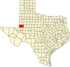
McKinney Acres is located at 32°17′47″N 102°31′47″W / 32.29639°N 102.52972°W / 32.29639; -102.52972 (32.296357, -102.529776).[3] It lies along the southern border of Andrews, the county seat. U.S. Route 385 runs along the western edge of the CDP, leading south 32 miles (51 km) to Odessa.
According to the United States Census Bureau, the CDP has a total area of 1.7 square miles (4.3 km2), all land.[1]
References
- ^ a b "Geographic Identifiers: 2010 Demographic Profile Data (G001): McKinney Acres CDP, Texas". U.S. Census Bureau, American Factfinder. Archived from the original on February 12, 2020. Retrieved August 9, 2013.
- ^ "Population and Housing Unit Counts, 2010 Census of Population and Housing" (PDF). Texas: 2010. Retrieved January 10, 2017.
- ^ "US Gazetteer Files 2016-Places-Texas". US Census. Retrieved January 10, 2017.
- v
- t
- e
Municipalities and communities of Andrews County, Texas, United States
County seat: Andrews
- McKinney Acres
communities
- Texas portal
- United States portal
 | This article about a location in Andrews County, Texas is a stub. You can help Wikipedia by expanding it. |
- v
- t
- e


