Municipal District of Bighorn No. 8
Municipal district in Alberta, Canada
Municipal district in Alberta, Canada
Seal


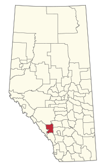
Location within Alberta
(2021)[2]
(2021)[2]
The Municipal District of Bighorn No. 8 is a municipal district (MD) situated in Census Division No. 15 of Alberta, Canada. It is located between Calgary and Banff National Park, north of Kananaskis Improvement District. Highway 1 (the Trans-Canada Highway) passes through the municipal district.
It was created as a municipal district on January 1, 1988 from the former Improvement District No. 8.[3] The Town of Canmore lies adjacent to the municipal district to the southwest.
Communities and localities
| The following urban municipalities are surrounded by the MD of Bighorn No. 8.[4]
| The following hamlets are located within the MD of Bighorn No. 8.[4]
|
The following localities are located within the MD of Bighorn No. 8.[5]
- Localities
- Gap
- Improvement District No. 8
- Jumping Pound (Forest Res)
- Kananaskis
- Spray Lakes
Demographics
In the 2021 Census of Population conducted by Statistics Canada, the MD of Bighorn No. 8 had a population of 1,598 living in 640 of its 875 total private dwellings, a change of 20.7% from its 2016 population of 1,324. With a land area of 2,678.8 km2 (1,034.3 sq mi), it had a population density of 0.6/km2 (1.5/sq mi) in 2021.[2]
In the 2016 Census of Population conducted by Statistics Canada, the MD of Bighorn No. 8 had a population of 1,334 living in 556 of its 766 total private dwellings, a -0.5% change from its 2011 population of 1,341. With a land area of 2,761.18 km2 (1,066.10 sq mi), it had a population density of 0.5/km2 (1.3/sq mi) in 2016.[6]
See also
- List of communities in Alberta
- List of francophone communities in Alberta
- List of municipal districts in Alberta
References
- ^ Alberta Municipal Affairs: Municipal Officials Search
- ^ a b c "Population and dwelling counts: Canada, provinces and territories, and census subdivisions (municipalities)". Statistics Canada. February 9, 2022. Retrieved February 9, 2022.
- ^ Municipal District of Bighorn No. 8 profile - Alberta Municipal Affairs
- ^ a b "Specialized and Rural Municipalities and Their Communities" (PDF). Alberta Municipal Affairs. January 12, 2022. Retrieved January 21, 2022.
- ^ "Standard Geographical Classification (SGC) 2006, Economic Regions: 4815015 - Bighorn No. 8, geographical codes and localities, 2006". Statistics Canada. March 5, 2010. Archived from the original on August 28, 2011. Retrieved August 11, 2012.
- ^ "Population and dwelling counts, for Canada, provinces and territories, and census subdivisions (municipalities), 2016 and 2011 censuses – 100% data (Alberta)". Statistics Canada. February 8, 2017. Retrieved February 8, 2017.
External links
- Official website

Places adjacent to Municipal District of Bighorn No. 8 | |
|---|---|


- v
- t
- e
Subdivisions of Alberta
service areas
municipalities
municipalities
- Crowsnest Pass, Municipality of
- Jasper, Municipality of
- Lac La Biche County
- Mackenzie County
- Strathcona County
- Wood Buffalo, Regional Municipality of
 Category
 Canada portal
 WikiProject


Authority control databases | |
|---|---|
| International |
|
| National |
|


