Muscadine, Alabama
Unincorporated community in Alabama, United States
Unincorporated community in Alabama, United States
33°44′04″N 85°23′10″W / 33.73444°N 85.38611°W / 33.73444; -85.3861136269
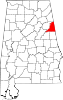
Muscadine is an unincorporated community in Cleburne County, Alabama, United States. It is near the Alabama-Georgia state line. Muscadine is 2.75 miles (4.43 km) east of Fruithurst. Muscadine has a post office with ZIP code 36269, a general store, and a bar.[2][3]
Demographics
| Census | Pop. | Note | %± |
|---|---|---|---|
| 1890 | 100 | — | |
| 1900 | 132 | 32.0% | |
| 1910 | 130 | −1.5% | |
| 1920 | 114 | −12.3% | |
| 1930 | 98 | −14.0% | |
| U.S. Decennial Census[4] | |||
Muscadine was an incorporated community for a time and was listed on the U.S. Census from 1890 to 1930. It peaked at 132 persons in 1900.
References
- ^ "Muscadine". Geographic Names Information System. United States Geological Survey, United States Department of the Interior.
- ^ United States Postal Service (2012). "USPS - Look Up a ZIP Code". Retrieved February 15, 2012.
- ^ "Postmaster Finder - Post Offices by ZIP Code". United States Postal Service. Archived from the original on October 17, 2020. Retrieved June 4, 2013.
- ^ "U.S. Decennial Census". Census.gov. Retrieved June 6, 2013.
- v
- t
- e
Municipalities and communities of Cleburne County, Alabama, United States
County seat: Heflin
communities
- Abel
- Abernathy
- Ai
- Arbacoochee
- Chulafinnee
- Hopewell
- Liberty Hill
- Muscadine
- Trickem
- Alabama portal
- United States portal
| Authority control databases: Geographic |
|
|---|
 | This Cleburne County, Alabama state location article is a stub. You can help Wikipedia by expanding it. |
- v
- t
- e


