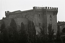
Piandimeleto
Comune in Marche, Italy

Coat of arms
Location of Piandimeleto

43°44′N 12°25′E / 43.733°N 12.417°E / 43.733; 12.417
61026
Piandimeleto is a comune (municipality) in the Province of Pesaro e Urbino in the Italian region Marche, located about 90 kilometres (56 mi) west of Ancona and about 45 kilometres (28 mi) southwest of Pesaro.
Piandimeleto borders the following municipalities: Belforte all'Isauro, Carpegna, Frontino, Lunano, Macerata Feltria, Pietrarubbia, Sant'Angelo in Vado, Sassocorvaro Auditore, Sestino, Urbino. Its territory is included in the Sasso Simone and Simoncello Regional Park. The Foglia river flows near the town.
References
- ^ "Superficie di Comuni Province e Regioni italiane al 9 ottobre 2011". Italian National Institute of Statistics. Retrieved 16 March 2019.
- ^ All demographics and other statistics: Italian statistical institute Istat.
- ^ "Popolazione Residente al 1° Gennaio 2018". Italian National Institute of Statistics. Retrieved 16 March 2019.
External links
- Official website
- v
- t
- e
- Acqualagna
- Apecchio
- Belforte all'Isauro
- Borgo Pace
- Cagli
- Cantiano
- Carpegna
- Cartoceto
- Colli al Metauro
- Fano
- Fermignano
- Fossombrone
- Fratte Rosa
- Frontino
- Frontone
- Gabicce Mare
- Gradara
- Isola del Piano
- Lunano
- Macerata Feltria
- Mercatello sul Metauro
- Mercatino Conca
- Mombaroccio
- Mondavio
- Mondolfo
- Monte Cerignone
- Monte Grimano
- Monte Porzio
- Montecalvo in Foglia
- Montecopiolo
- Montefelcino
- Montelabbate
- Peglio
- Pergola
- Pesaro
- Petriano
- Piandimeleto
- Pietrarubbia
- Piobbico
- San Costanzo
- San Lorenzo in Campo
- Sant'Angelo in Vado
- Sant'Ippolito
- Sassocorvaro Auditore
- Sassofeltrio
- Serra Sant'Abbondio
- Tavoleto
- Tavullia
- Terre Roveresche
- Urbania
- Urbino
- Vallefoglia
| Authority control databases |
|
|---|
 | This Marche location article is a stub. You can help Wikipedia by expanding it. |
- v
- t
- e


