Ploughley Rural District
Ploughley was a rural district in Oxfordshire, England, from 1932 to 1974.[1] It entirely surrounded Bicester but did not include it.
It was created in 1932 from parts of the abolished Bicester Rural District, Headington Rural District and Woodstock Rural District, along with a couple of non-urban parishes from Bicester urban district.
In 1974 it was abolished under the Local Government Act 1972 and now forms part of the Cherwell district.
References
- ^ Ploughley Rural District – Vision of Britain website
External links
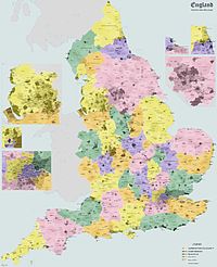
- Ploughley Rural District boundary map – Vision of Britain website
51°51′N 1°14′W / 51.850°N 1.233°W / 51.850; -1.233
- v
- t
- e
The District of Cherwell
- Oxfordshire
- County Council elections
- District Council elections
- Banbury County Constituency
- Oxford West and Abingdon County Constituency
- Witney County Constituency
- Banbury
- Bicester

- Adderbury
- Ambrosden
- Arncott
- Bloxham
- Bodicote
- Caversfield
- Deddington (Clifton
- Hempton)
- Hook Norton
- Kidlington
- Launton
- Upper Heyford
- Yarnton
(component villages
and hamlets)
- Ardley (Fewcott)
- Barford St. John and St. Michael (Barford St. Michael
- Barford St. John)
- Begbroke
- Blackthorn
- Bletchingdon (Enslow)
- Bourton (Great Bourton
- Little Bourton)
- Broughton
- Bucknell
- Charlton-on-Otmoor
- Chesterton (Little Chesterton)
- Claydon with Clattercot (Claydon
- Clattercote)
- Cottisford (Juniper Hill)
- Cropredy
- Drayton
- Duns Tew
- Epwell
- Fencott and Murcott (Fencott
- Murcott)
- Finmere
- Fringford
- Fritwell
- Godington
- Gosford and Water Eaton (Gosford
- Water Eaton)
- Hampton Gay and Poyle (Hampton Gay
- Hampton Poyle)
- Hanwell
- Hardwick with Tusmore (Hardwick
- Tusmore)
- Hethe (Willaston)
- Horley
- Hornton
- Horton-cum-Studley
- Islip
- Kirtlington (Northbrook)
- Lower Heyford (Caulcott)
- Merton
- Middle Aston
- Middleton Stoney
- Milcombe
- Milton
- Mixbury
- Mollington
- Newton Purcell with Shelswell (Newton Purcell
- Shelswell)
- Noke
- North Aston
- North Newington
- Oddington
- Piddington
- Prescote
- Shenington with Alkerton (Shenington
- Alkerton)
- Shipton-on-Cherwell and Thrupp (Shipton-on-Cherwell
- Thrupp)
- Shutford
- Sibford Ferris
- Sibford Gower (Burdrop)
- Somerton
- Souldern
- South Newington
- Steeple Aston
- Stoke Lyne (Bainton)
- Stratton Audley
- Swalcliffe
- Tadmarton
- Wardington (Lower Wardington
- Upper Wardington)
- Wendlebury
- Weston-on-the-Green
- Wigginton
- Wroxton (Balscote)
and boroughs
- Municipal Borough of Banbury
- Banbury Rural District
- Bicester Urban District
- Ploughley Rural District
- Bicester Rural District
constituencies
- Oxfordshire County Constituency
- Mid Oxfordshire or Woodstock County Constituency
- Mid Oxfordshire County Constituency
 | This Oxfordshire location article is a stub. You can help Wikipedia by expanding it. |
- v
- t
- e


