Podjelovo Brdo
Place in Upper Carniola, Slovenia
46°06′08″N 14°02′22″E / 46.10222°N 14.03944°E / 46.10222; 14.03944 Slovenia
 (2020)
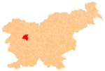
Podjelovo Brdo (pronounced [pɔˈdjeːlɔʋɔ ˈbəɾdɔ]; German: Podjelowoberdo[2]) is a dispersed settlement in the Škofja Loka Hills, west of Gorenja Vas, in the Municipality of Gorenja Vas–Poljane in the Upper Carniola region of Slovenia.[3]
References
External links
 Media related to Podjelovo Brdo at Wikimedia Commons
- Podjelovo Brdo on Geopedia
- v
- t
- e
Administrative seat: Gorenja Vas
- Holy Cross Church
- St. Martin's Parish Church
- Vlastja Simonič Museum
 | This article about the Municipality of Gorenja vas-Poljane in Slovenia is a stub. You can help Wikipedia by expanding it. |
- v
- t
- e


