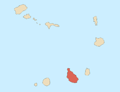
Ponta Moreia
15°20′25″N 23°44′33″W / 15.34016°N 23.74253°W / 15.34016; -23.74253Location Northern Santiago, Cape Verde Offshore water bodies Atlantic Ocean Mountains 
Streams Points and promontories Other geographic features Transportation Other topics
Ponta Moreia is the northernmost point of the island of Santiago, Cape Verde.[1] It is about 2 km north of the nearest village, Fazenda, and around 5 km north of Tarrafal.
There is a lighthouse near the headland, Farol de Ponta Moreia. It is an 8 metres high tower, with a focal plane of 97 meters above sea level.[2][3]
References
- ^ Cabo Verde, Statistical Yearbook 2015, Instituto Nacional de Estatística, p. 26
- ^ List of Lights, Pub. 113: The West Coasts of Europe and Africa, the Mediterranean Sea, Black Sea and Azovskoye More (Sea of Azov) (PDF). List of Lights. United States National Geospatial-Intelligence Agency. 2018. p. 427.
- ^ Rowlett, Russ. "Lighthouses of Cape Verde". The Lighthouse Directory. University of North Carolina at Chapel Hill.
- v
- t
- e
The island of Santiago
- Pico de Antónia
- Monte Graciosa
- Serra Malagueta
- Monte Tchota
- Monte das Vacas

- Ribeira Grande de Santiago
- Ribeira Principal
- Ribeira Seca
- Ribeira da Trindade
- Ponta Bicuda
- Ponta das Bicudas
- Ponta do Lobo
- Ponta Moreia
- Ponta Preta
- Ponta Temerosa
 Category
 | This Cape Verdean location article is a stub. You can help Wikipedia by expanding it. |
- v
- t
- e


