River Foss
River in North Yorkshire, England
54°09′38″N 1°07′54″W / 54.160556°N 1.131667°W / 54.160556; -1.131667
• location
• coordinates
• elevation
River Foss | ||||||||||||||||||||||||||||||||||||||||||||||||||||||||||||||||||||||||||||||||||||||||||||||||||||||||||||||||||||||||||||||||||||||||||||||||||||||||||||||||||||||||||||||||||||||||||||||||||||||||||||||||||||||||||||||||||||||||||||||||||||||||||||||||||||||||||||||||||||||||||||||||||||||||||||||||||||||||||||||||||||||||||||||||||||||||||||||||||||||||||||||||||||||||||||||||||||||||
|---|---|---|---|---|---|---|---|---|---|---|---|---|---|---|---|---|---|---|---|---|---|---|---|---|---|---|---|---|---|---|---|---|---|---|---|---|---|---|---|---|---|---|---|---|---|---|---|---|---|---|---|---|---|---|---|---|---|---|---|---|---|---|---|---|---|---|---|---|---|---|---|---|---|---|---|---|---|---|---|---|---|---|---|---|---|---|---|---|---|---|---|---|---|---|---|---|---|---|---|---|---|---|---|---|---|---|---|---|---|---|---|---|---|---|---|---|---|---|---|---|---|---|---|---|---|---|---|---|---|---|---|---|---|---|---|---|---|---|---|---|---|---|---|---|---|---|---|---|---|---|---|---|---|---|---|---|---|---|---|---|---|---|---|---|---|---|---|---|---|---|---|---|---|---|---|---|---|---|---|---|---|---|---|---|---|---|---|---|---|---|---|---|---|---|---|---|---|---|---|---|---|---|---|---|---|---|---|---|---|---|---|---|---|---|---|---|---|---|---|---|---|---|---|---|---|---|---|---|---|---|---|---|---|---|---|---|---|---|---|---|---|---|---|---|---|---|---|---|---|---|---|---|---|---|---|---|---|---|---|---|---|---|---|---|---|---|---|---|---|---|---|---|---|---|---|---|---|---|---|---|---|---|---|---|---|---|---|---|---|---|---|---|---|---|---|---|---|---|---|---|---|---|---|---|---|---|---|---|---|---|---|---|---|---|---|---|---|---|---|---|---|---|---|---|---|---|---|---|---|---|---|---|---|---|---|---|---|---|---|---|---|---|---|---|---|---|---|---|---|---|---|---|---|---|---|---|---|---|---|---|---|---|---|---|---|---|---|---|---|---|---|---|---|---|---|---|---|---|---|---|---|---|---|---|---|---|---|---|---|---|---|---|
Legend | ||||||||||||||||||||||||||||||||||||||||||||||||||||||||||||||||||||||||||||||||||||||||||||||||||||||||||||||||||||||||||||||||||||||||||||||||||||||||||||||||||||||||||||||||||||||||||||||||||||||||||||||||||||||||||||||||||||||||||||||||||||||||||||||||||||||||||||||||||||||||||||||||||||||||||||||||||||||||||||||||||||||||||||||||||||||||||||||||||||||||||||||||||||||||||||||||||||||||
| ||||||||||||||||||||||||||||||||||||||||||||||||||||||||||||||||||||||||||||||||||||||||||||||||||||||||||||||||||||||||||||||||||||||||||||||||||||||||||||||||||||||||||||||||||||||||||||||||||||||||||||||||||||||||||||||||||||||||||||||||||||||||||||||||||||||||||||||||||||||||||||||||||||||||||||||||||||||||||||||||||||||||||||||||||||||||||||||||||||||||||||||||||||||||||||||||||||||||


The River Foss is in North Yorkshire, England. It is a tributary of the River Ouse. It rises in the Foss Crooks Woods near Oulston Reservoir close to the village of Yearsley and runs south through the Vale of York to the Ouse in the centre of York. The name most likely comes from the Latin word Fossa, meaning ditch.[1] It is mentioned in the Domesday Book.[2] The York district was settled by Norwegian and Danish people, so parts of the place names could be old Norse. Referring to the etymological dictionary "Etymologisk ordbog", ISBN 82-905-2016-6 deals with the common Danish and Norwegian languages – roots of words and the original meaning. The old Norse word Fos (waterfall) means impetuous. The River Foss was dammed, and even though the elevation to the River Ouse is small, a waterfall was formed. This may have led to the name Fos which became Foss.
The responsibility for the management of the river's drainage area is the Foss Internal drainage board (IDB). It has responsibility for the area from Crayke to the pre-1991 city boundary of York covering 9,085 hectares and 162.54 km of waterways. The Foss IDB is part of the York Consortium of Drainage Boards that oversees 10 IDB's in the Yorkshire region.[3]
The typical river level range at the Foss Barrier is between 5.05m and 7.90m. The highest river level recorded was 10.20 metres and the river level reached 9.34 metres on 23 January 2008.[4]
Course
The source of the Foss is a spring in the Howardian Hills adjacent to, and flowing into, Oulston Reservoir near Newburgh Priory, four miles (6.5 km) north of Easingwold. From there to the Blue Bridge in York, where it joins the Ouse, it is 19.5 miles (31 km) in length. For part of its way it runs close to the B1363 between Brandsby and Stillington. The river flows in wide meanders in a southerly direction for most of its course towards York. As of 2010 the river is navigable for some 1.5 miles (2 km) upstream of Castle Mills Lock. The bridges by Peasholme Green and Foss Bank restrict the headroom to an air space of 2.4 metres.
River modifications

The Foss Barrier was built across the river near its mouth at Castle Mills. When closed, it prevents floodwater from the Ouse forcing the flow of the Foss back on itself. When the Ouse reaches 7.4m above ordnance datum, the staff at the barrier are alerted. When the level reaches 7.8m AOD the barrier is lowered after running pumps for several minutes to clear silt and debris from the river bed to make a watertight fit. It takes four minutes to lower the barrier.

To avoid the build-up of water behind the barrier causing the Foss to burst its banks, water is pumped around the barrier into the Ouse by eight pumps that pump water at 30 tonnes per second preventing the Foss flowing back on itself. The water pumped out should maintain a water level of 6.5m AOD behind the barrier. When both sides of the barrier are equalised, the barrier is raised.[5]
Castle Mills Lock is 34 metres long and 6 metres wide. There are mooring points in the lock basin on the Ouse side and overnight mooring on the Foss is prohibited. Beyond Rowntree Wharf there are few opportunities for turning.[6]
History
In 1069 William the Conqueror dammed the Foss just south of York Castle, close to its confluence with the Ouse creating a moat around the castle.[2] It caused the river to flood further upstream in what is now the Hungate and Layerthorpe areas, forming a large lake that was known as the "King's Pool" or the "King's Fish Pond" and which provided fish for the markets.[6] The lake was approximately 100 acres in extent and fishing was allowed by licence, except for the King's Men.[2]
The King's Pool was part of the city's inner defences during the Middle Ages as the marsh was virtually impassable and explains why there is no city wall between Layerthorpe Postern and the Red Tower.[6]
In the 17th century, the King's Pool and the Foss were in decline because silt from upriver collected in the Pool, and not enough water came down to move it on despite the main channel of the River Foss having been deepened in 1608.[2] Eventually the lake was too shallow to remain viable as a defence. In 1644 the lake was shallow enough for Parliamentarian forces under Sir Thomas Fairfax to consider crossing it on foot to break the Siege of York during the English Civil War.[6]
In 1727 an order was placed upon Arthur Ingram, 6th Viscount of Irvine to scour the River Foss from the Castle Mills to Foss Bridge, making it eight yards wide at the top and four yards at the bottom, and, in 1731 the Little Foss, the extension to enclose the castle was drained.[2] In the 18th century, the water was so low that marshy islands were created (hence the modern name Foss Islands). Citizens used the river as a rubbish tip which became a health hazard. Acts of Parliament in 1793 and 1801 were enacted to make the Foss navigable[2] and saw the end of the King's Pool. The Foss Navigation Company canalised the river from 1778,[2] to make it navigable as far as Sheriff Hutton.[6]
The York Drainage and Sanitary Improvement Act 1853 saw York Corporation purchase the River Foss from the Foss Navigation Company. In 1859, the York Improvement Act was passed and the river above Yearsley Bridge was abandoned as a waterway.[2]
Stillington Hall was a mansion on the west side of the Foss and adjoining the village of the same name. It was the home of the Croft family, who are descended from a common ancestor with the house of Croft, of Croft Castle in Herefordshire.[2]
Economy
Remains of Roman jetties, wharves and warehouses have been found by excavations and building works on the banks of the Foss, suggesting that water-borne transport and trade were important from early in the history of the city.[7]
The modern Foss benefits most from leisure activity and several long-distance walks cross its path. The Foss Walk follows much of the river course from Blue Bridge to Oulston Reservoir and on to Easingwold, a distance of 28 miles (45 km).[8] Part of the Howardian Way[9] near Yearsley and both the Ebor Way[10] and Centenary Way[11] as far as West Lilling also follow the Foss for part of their way.
Ecology
Several species of fish are found in the river, such as Pike, Dace, Chub, Gudgeon, Perch and Roach. At the start of the century, Barbel have been introduced into the river.[12]
River Foss Barrier
Flooding of the River Ouse occurs periodically in York. This is part of a series of schemes designed by the Yorkshire Water Authority.
The River Foss is a left bank tributary of the River Ouse, situated near the York Castle.
In the years 1947, 1978, 1982 and end of 2015 flooding occurred causing many areas to be under water.
In 1982, a feasibility study was undertaken that indicated flood levels in the Foss are directly related to River Ouse levels.
A barrier was proposed to counteract the backwash of the Ouse into the River Foss.[13] In 2016 funds were allocated to upgrade the existing facilities to improve the pumping capacity.
Lists
Source for this section comes from the Ordnance Survey Open Source Mapping[14]
Tributaries
There are many small streams that feed into the Foss north of Strensall. The main ones are:
- Eller's Beck, North-west of Crayke.
- Brandsby Beck, South-west of Crayke
- Farlington Beck, south of Farlington
- Whitecarr Beck, near Sherriff Hutton Bridge
- Howl Beck, near Sherriff Hutton Bridge
- Black Dike near Strensall
Settlements
North to south, to the confluence with the Ouse, these are:
- Stillington
- Strensall
- Haxby
- Earswick Village
- York
Bridges over the Foss
North to south, to the confluence with the Ouse, these are:
|
|
Gallery
Along the River Foss: Source to Confluence
-
 Oulston Reservoir near source of River Foss
54°09′48″N 1°08′10″W / 54.163205°N 1.136180°W / 54.163205; -1.136180 -
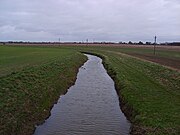
 River Foss near Crayke 2 miles from its source
54°8′16.55″N 1°8′1.12″W / 54.1379306°N 1.1336444°W / 54.1379306; -1.1336444 -
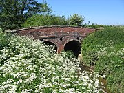 Bridge over the River Foss near Farlington
54°05′11″N 1°04′31″W / 54.086257°N 1.075253°W / 54.086257; -1.075253 -
 Bridge over River Foss in Strensall on road heading to Sherriff Hutton
54°02′27″N 1°02′03″W / 54.040824°N 1.034267°W / 54.040824; -1.034267 -
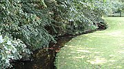
 River Foss in Strensall as seen from the Post Office
54°02′27″N 1°02′07″W / 54.040923°N 1.035334°W / 54.040923; -1.035334 -
 River Foss viewed from Towthorpe Bridge towards Strensall
54°01′30″N 1°03′12″W / 54.024888°N 1.053412°W / 54.024888; -1.053412 -
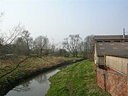
 River Foss New Earswick
53°58′59″N 1°04′44″W / 53.983022°N 1.078913°W / 53.983022; -1.078913 -
 River Foss Huntington Road, York
53°58′58″N 1°03′49″W / 53.982905°N 1.063667°W / 53.982905; -1.063667 -
 River Foss from Monk Bridge
53°57′57″N 1°04′23″W / 53.965901°N 1.073194°W / 53.965901; -1.073194 -
 Pedestrian bridge from the west, looking downstream near DEFRA buildings
53°57′37″N 1°04′22″W / 53.960272°N 1.072903°W / 53.960272; -1.072903 -
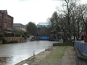
 Looking upstream from Foss Bridge to Rowntree Wharf, with Wormald's Cut to the right.
53°57′29″N 1°04′38″W / 53.957975°N 1.07725°W / 53.957975; -1.07725 -
 Castle Mills Lock and Basin, near the Foss Barrier and the confluence with River Ouse
53°57′15″N 1°04′41″W / 53.954078°N 1.077944°W / 53.954078; -1.077944 -
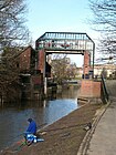
 The River Foss Barrier (closed), viewed from the north (Castle Mills Basin)
53°57′11″N 1°04′44″W / 53.95295°N 1.078769°W / 53.95295; -1.078769 -
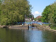
 The River Foss Barrier (open), viewed from the south
53°57′08″N 1°04′42″W / 53.952342°N 1.078394°W / 53.952342; -1.078394 -
 View from the River Ouse of the confluence and the "Blue Bridge"


References
- ^ "Origin of name". River Foss. Jim Shead. Retrieved 13 November 2010.
- ^ a b c d e f g h i "History". The history of the Castle of York from its foundation to the present day, with an account of the building of Clifford's Tower. Internet Archive. Retrieved 13 November 2010.
- ^ "Foss IDB". Foss IDB Information. York Consortium of Drainage Boards. Retrieved 6 December 2017.
- ^ "River levels". River Ouse at Foss Barrier. Environment Agency. Retrieved 12 December 2010.
- ^ Protecting York From the Threat of Floods – The Environment Agency
- ^ a b c d e "River Foss & Castle Mills Lock". River Foss. City of York Council. Archived from the original on 14 March 2012. Retrieved 13 November 2010.
- ^ "Trade". Trade on the rivers. History of York. Retrieved 13 November 2010.
- ^ "Foss Way". Foss Way. The Long Distance Walkers Association. Retrieved 13 November 2010.
- ^ "Howardian Way". Howardian Way. The Long Distance Walkers Association. Retrieved 13 November 2010.
- ^ "Ebor Way". Ebor Way. The Long Distance Walkers Association. Retrieved 13 November 2010.
- ^ "Centenary Way". Centenary Way (North Yorkshire). The Long Distance Walkers Association. Retrieved 13 November 2010.
- ^ "Fish stocks". York & District Amalgamation of Anglers Factsheets. Archived from the original on 1 November 2011. Retrieved 13 November 2011.
- ^ "NRA River Foss Flood Alleviation Scheme". York Press. Retrieved 15 March 2016.
- ^ Ordnance Survey Open Viewer
Sources
- Evans, Antonia, ed. (2002). The York Book. York: Blue Bridge. ISBN 0-9542749-0-3.
External links
 Media related to River Foss at Wikimedia Commons
Authority control databases | |
|---|---|
| International |
|
| National |
|


