Stanage Edge
Escarpment in the Peak District, England
| Stanage Edge | |
|---|---|
 | |
| Highest point | |
| Elevation | 458 m (1,503 ft) |
| Prominence | c. 103 m |
| Geography | |
| Location | Derbyshire / South Yorkshire |
| Parent range | Peak District |
| OS grid | SK228853 |
| Topo map | OS Landranger 110 |
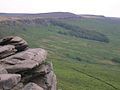
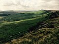
Stanage Edge, or simply Stanage (from "stone edge") is a gritstone escarpment in the Peak District, England, famous as a location for climbing. It lies a couple of miles to the north of Hathersage, and the northern part of the edge forms the border between the High Peak of Derbyshire and Sheffield in South Yorkshire. Its highest point is High Neb at 458 metres (1,503 ft) above sea level. Areas of Stanage were quarried in the past to produce grindstones, and some can still be seen on the hillside—carved, but never removed.
Features
A paved packhorse road ran along the top of the edge, and remains of it can be seen, as can remains of the Long Causeway, once thought to be a Roman road[1] which works its way over the edge on its route from Templeborough to Brough-on-Noe, crossing Hallam Moor and passing Stanedge Pole (note the slightly different spelling), an ancient waymarker on the route to Sheffield. Some cairns along the top are even older, and there is a well-known cave in the cliff known as Robin Hood's Cave. More recent features include early 20th-century drinking basins, designed to collect pure rainwater for grouse to drink.
During the construction of the Rivelin tunnel a sighting tower was constructed on the edge to assist in surveying the route of the tunnel. All that remains of the tower is a heap of stones at Ordnance Survey grid reference SK226862.[2]
Sport
Rock climbing

Stanage's naturally weathered Millstone Grit face is now known as a highly popular location for rock climbing in the Peak District. The edge runs three miles north from the Cowper Stone to Stanage End. It is the northernmost of an almost continuous line of cliffs, including Burbage Rocks, Froggatt Edge, Curbar Edge, Baslow Edge and Birchen Edge. The Cowper Stone is a block of gritstone at the most southerly point of Stanage. Set alone a few hundred metres from the last buttress of the main crag, it is a large boulder with distinctive rounded breaks running across it.[3] It is the scene of some classic hard-grit routes of the 1980s first climbed by protagonists such as Johnny Dawes and John Allen. The Edge was notably omitted from the first rock climbing guidebook to the Peak District, Some Gritstone Climbs by John Laycock, published in 1913, due to the then severe access restrictions to the land. It has subsequently been featured regularly in over a century of regular climbing guidebooks, which document the growth in the number of routes and the rise in climbing standards.[citation needed]
Although the edge reaches only 25 metres in height it is one of the most famous UK climbing venues: aside from having a multitude of routes close to a major population centre, it is home to the route Right Unconquerable (HVS 5a), which, when first climbed by Joe Brown in 1949, was considered a milestone achievement in British climbing.[citation needed] In spite of its height, the edge is home to the longest recorded rock route in the United Kingdom; the 5000m Girdle Traverse, completed by Ron Fawcett in 1992 and graded "E5 6b(ish)".[4]
Running
Stanage is a magnet for walkers and runners. The Fat Boys Stanage Struggle is a popular local fell race that starts in Hathersage—altitude 91 metres (299 ft)—and routes up to and along Stanage Edge to High Neb—458 metres (1,503 ft)—before returning to the village 367 metres (1,204 ft) below.[5] The 19 September 2021 edition of the event was won in a time of 40m 51s by Michael Kenyon of Dronfield Running Club; there were 224 finishers.[6]
In popular culture
The location has featured in films and television series, most notably in the 2005 film Pride and Prejudice during a scene in which Elizabeth Bennet (portrayed by Keira Knightley) is seen facing the horizon from the Edge.
Gallery
-
 The Cowper Stone
 -

-
-


See also
- Standedge, a moorland escarpment and Pennine crossing point
References
Wikimedia Commons has media related to Stanage Edge.
- ^ "Long Causeway Management Plan" (PDF). Peak District National Park. Retrieved 4 December 2017.
- ^ Cass, J. F. "The Rivelin Tunnel 1903". Transactions of the Hunter Archaeological Society. 18: 60–74.
- ^ Rockfax page on the Cowperstone
- ^ Stanage (BMC Guide), David Simmonite et al, (2002) ISBN 0-903908-42-5
- ^ "Fat Boys Stanage Struggle Fell Race". RaceCheck. Retrieved 20 September 2021.
- ^ Struggle Results 2021. Retrieved: 20 September 2021.
53°20′50.25″N 1°37′59.74″W / 53.3472917°N 1.6332611°W / 53.3472917; -1.6332611
- v
- t
- e
Peaks of the Peak District of England
- Black Hill
- The Cloud
- Gun
- Kinder Scout
- Shining Tor

- Abney Low
- Aleck Low
- Allman Well Hill
- Alport Height
- Axe Edge Moor
- Back Tor
- Beeley Moor
- Big Moor
- Birchen Edge
- Blacka Moor
- Black Chew Head
- Black Edge
- Blake Low
- Blakelow Hill
- Bleaklow
- Bole Hill
- Bolehill
- Bosley Minn
- Britland Edge Hill
- Brittain's Plantation
- Brown Knoll
- Bunster Hill
- Burbage Edge
- Burton Bole End
- Calver Peak
- Cheeks Hill
- Chinley Churn
- Chrome Hill
- The Cloud
- Combs Moss
- Corbar Hill
- Croker Hill
- Crook Hill
- Dead Edge End
- Derwent Edge
- Durham Edge
- Eccles Pike
- Ecton Hill
- Eldon Hill
- Emlin
- Eyam Moor - Sir William Hill
- Featherbed Moss
- Featherbed Top
- Fin Cop
- Froggatt Edge
- Gardom's Edge
- Gautries Hill
- Gibraltar Rocks
- Gratton Hill
- Great Ridge
- Grindslow Knoll
- Grin Low
- Gun
- Harborough Rocks
- Hare Edge Hill
- Harridge Pike
- Hartcliff Hill
- Haven Hill
- Hawks Low
- The Height
- Heights of Abraham
- Higger Tor
- High Edge
- High Field
- High Low
- Hollins Hill
- High Neb
- High Wheeldon
- Higher Shelf Stones
- Hollins Cross
- Houndkirk Hill
- Lantern Pike
- Lees Moor
- Longstone Moor
- Lord's Seat
- Lose Hill
- Lost Lad
- Low Moor
- Mam Tor
- Margery Hill
- Merryton Low
- Middleton Moor
- Minninglow Hill
- Mount Famine
- Nelson's Monument
- Ossoms Hill
- Parkhouse Hill
- Pike Low
- Pikenaze Hill
- The Roaches
- Rock Hall
- Rushup Edge
- Sheen Hill
- Shutlingsloe
- Slipper Low
- Snailsden Pike End
- Snels Low
- South Head
- Sponds Hill
- Stanage Edge
- Stanton Moor
- Tegg's Nose
- Thorpe Cloud
- Totley Moor
- Ughill Height
- Wardlow Hay Cop
- West Nab
- Wetton Hill
- Whaley Moor
- Wibben Hill
- Wild Bank
- Win Hill
- Windgather Rocks
- Wire Stone
- Wolfscote Hill


