Tai Po Waterfront Park
Public park in Tai Po, Hong Kong


Tai Po Waterfront Park (Chinese: 大埔海濱公園) is a park in Tai Po in the New Territories of Hong Kong. It is located along the Tolo Harbour, and its western end is at the northern part of the mouth of the Lam Tsuen River. It occupies an area of 22 hectares (54 acres), and is the largest park managed by the Leisure and Cultural Services Department.[1] The Park opened in 1994 at a cost of $210-million,[1] but was not completed until 1997 with the creation of the Tai Po Lookout Tower.
Every year, the Tai Po Dragon Boat Race is held in the sea off the park.
Facilities
The park has a wide range of public facilities including rest gardens, sitting-out areas, an insect house, a 1.2 kilometres (0.75 mi) promenade along the harbour front, a jogging trail with fitness stations and a 600-seat amphitheatre. The park also has the only dedicated model boat pool in Hong Kong. The park is also the start of the popular cycle route to Tai Mei Tuk. Cycle hires are available in the park.
Lookout tower

The lookout tower is 32.4 metres (106 ft) high and gives visitors a panoramic view over Tolo Harbour, the Tai Po Industrial Estate and the rugged countryside stretching back to the boundary with mainland China.
The plaques of the lookout tower depict the history of Tai Po, including the struggle with the British army when they originally entered the New Territories, the heroic resistance against the Japanese army during the occupation and prosperity after World War II.[2]
Gallery
-
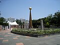 Central water feature
 -
 Insect House
 -
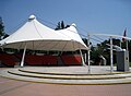 Amphitheatre
 -
 Herbs Garden
 -
 Lawn for Wedding
 -
 Technology Children Playground
 -
 Model boat pool
 -
 Bridge
 -
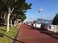 Seaside promenade
 -
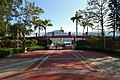 Entrance near industrial estate
 -
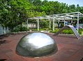
 Some installation art about elephant and rainbow


References
- ^ a b LCSD: Tai Po Waterfront Park
- ^ My Heart My Home: Tai Po Distrist
See also
Wikimedia Commons has media related to Tai Po Waterfront Park.
- v
- t
- e
Tai Po District
- Kau Lung Hang
- Lai Chi Chong
- Lam Tsuen
- Pak Shek Kok
- Sha Lo Tung
- Shap Sze Heung
- Tai Mei Tuk
- Tai Po
- Tai Po Kau
- Ting Kok
- A Chau (丫洲, Centre Island)
- Breaker Reef
- Bun Sha Pai (崩紗排)
- Cham Pai (杉排)
- Chau Tsai Kok (洲仔角)
- Che Lei Pai (扯里排)
- Chek Chau (赤洲, Port Island)
- Flat Island (銀洲)
- Hau Tsz Kok Pai (孝子角排)
- Hin Pai (蜆排)
- Kung Chau (弓洲)
- Ma Shi Chau (馬屎洲)
- Ma Yan Pai (媽印排)
- Mo Chau (磨洲)
- Ping Chau (平洲)
- Sam Pui Chau (三杯酒)
- Sha Pai (沙排)
- Shek Ngau Chau (石牛洲)
- Tang Chau (燈洲)
- Tap Mun Chau (塔門洲, Grass Island)
- Tit Shue Pai (鐵樹排)
- Tung Ping Chau
- Wai Chau Pai (灣仔排)
- Wu Chau (烏洲)
- Yeung Chau (洋洲)
- Yim Tin Tsai
- Cloudy Hill
- Hong Kong Railway Museum
- Hong Lok Yuen
- Kadoorie Farm and Botanic Garden
- Lam Tsuen Valley
- Lam Tsuen wishing trees
- Mang Gui Kiu
- Museum of Ethnology
- Plover Cove
- Sai Kung West Country Park
- Tai Po Industrial Estate
- Tai Po Kau Nature Reserve
- Tai Po Lookout
- Tai Po Sports Ground
- Tai Po Waterfront Park
- Three Fathoms Cove
- Historic churches of Sai Kung Peninsula
| MTR stations |
|
|---|
| Primary/secondary | |
|---|---|
| Higher education |
This list is incomplete.
22°27′09″N 114°11′18″E / 22.4524°N 114.1883°E / 22.4524; 114.1883


