Tiébissou Department

Department in Lacs, Ivory Coast
Tiébissou Department
Département de Tiébissou
Location in Ivory Coast. Tiébissou Department has had these boundaries since 2005.
Country Ivory Coast
DistrictLacs
RegionBélier
1998Established as a second-level subdivision via a division of Yamoussoukro Dept
2005Divided to create Didiévi Dept
2011Converted to a third-level subdivision
Departmental seatTiébissou
Government
 • PrefectPascal Kifory Ouattara
Area
 • Total2,480 km2 (960 sq mi)
Population
 (2021 census)[2]
 • Total116,321
 • Density47/km2 (120/sq mi)
Time zoneUTC+0 (GMT)

Tiébissou Department is a department of Bélier Region in Lacs District, Ivory Coast. In 2021, its population was 116,321 and its seat is the settlement of Tiébissou. The sub-prefectures of the department are Lomokankro, Molonou, Tiébissou, and Yakpabo-Sakassou.

History

Tiébissou Department upon its creation in 1998. It kept these boundaries until 2005, but other subdivision boundary changes began to be made in 2000.

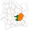
Tiébissou Department was created in 1998 as a second-level subdivision via a split-off from Yamoussoukro Department.[3] At its creation, it was part of Lacs Region.

In 2005, Tiébissou Department was divided in order to create Didiévi Department.[3]

In 2011, districts were introduced as new first-level subdivisions of Ivory Coast. At the same time, regions were reorganised and became second-level subdivisions and all departments were converted into third-level subdivisions. At this time, Tiébissou Department became part of Bélier Region in Lacs District.

Notes

  1. ^ "Préfets de Région et de Préfets de Département (Conseil des ministres du mercredi 26 septembre 2012)", abidjan.net, 2 October 2012.
  2. ^ Citypopulation.de Population of the regions and departments of Ivory Coast
  3. ^ a b "Regions of Côte d'Ivoire (Ivory Coast)", statoids.com, accessed 16 February 2016.
  • v
  • t
  • e
Abidjan Autonomous District
Bas-Sassandra District
Gbôklé Region
Nawa Region
San-Pédro Region
Comoé District
Indénié-Djuablin Region
Sud-Comoé Region
Denguélé District
Folon Region
Kabadougou Region
Gôh-Djiboua District
Gôh Region
Lôh-Djiboua Region
Lacs District
Bélier Region
Iffou Region
Moronou Region
N'Zi Region
Lagunes District
Agnéby-Tiassa Region
Grands-Ponts Region
La Mé Region
Montagnes District
Cavally Region
Guémon Region
Tonkpi Region
Sassandra-Marahoué District
Haut-Sassandra Region
Marahoué Region
Savanes District
Bagoué Region
Poro Region
Tchologo Region
Vallée du Bandama District
Gbêkê Region
Hambol Region
Woroba District
Bafing Region
Béré Region
Worodougou Region
Yamoussoukro Autonomous District
Zanzan District
Bounkani Region
Gontougo Region
Defunct departments
  • Centre (1961–69)
  • Centre-Ouest (1963–69)
  • Est (1963–69)
  • Nord (1961–69)
  • Ouest (1961–69)
  • Sud (1961–69)
Authority control databases Edit this at Wikidata
  • VIAF

7°16′N 5°29′W / 7.267°N 5.483°W / 7.267; -5.483


Stub icon

This Lacs District location article is a stub. You can help Wikipedia by expanding it.

  • v
  • t
  • e