Typhoon Bualoi was a tropical cyclone that formed during October 2019. The fortieth tropical depression, and the eleventh typhoon of the 2019 Pacific typhoon season, Bualoi originated from a disturbance east of the Marshall Islands on October 17, 2019, that quickly organized to a tropical depression on October 19, earning the designated name 22W. Favorable conditions strengthened the depression into a tropical storm. The Japan Meteorological Agency gave it the name Bualoi in response. Bualoi rapidly intensified and became a typhoon on October 20, before its rate of strengthening was stopped by a tropical upper tropospheric trough the following day. The rate was later recommenced through rapid intensification, making Bualoi reach its peak on October 22 as a Category 5-equivalent typhoon, with 10-minute sustained winds of 185 km/h (115 mph) and one-minute sustained winds of 260 km/h (160 mph). Bualoi rapidly weakened on October 23 due to wind shear and continued before transitioning into an extratropical cyclone and dissipating on October 25.
After affecting the Mariana Islands, where an emergency declaration was issued, warm moist air flowed into Bualoi, causing the atmosphere to become unstable and produce torrential rains over Japan on October 25. Around that time, the country was still in the recovery process after Typhoons Faxai and Hagibis had devastated the archipelago. Most of the damage occurred in Chiba Prefecture, though other prefectures such as Miyagi and Fukushima Prefectures, were also affected. Across the prefectures, about half of the 13 fatalities took place in a car as the automobiles were swept or submerged in rivers flooded by the rain, and happened during evacuation. Transportation services were also stopped in the affected areas. About 4,998 houses were destroyed, contributing to the total of over US$200 million in damages.
A low-pressure area located just north of Namonuito Atoll persisted on October 16, and generally tracked westward.[1] The area was later reported to have developed into a tropical depression on October 18, according to the Japan Meteorological Agency (JMA).[2] Later that day, the Joint Typhoon Warning Center (JTWC) issued a Tropical Cyclone Formation Alert on the system, designating it Invest 97W, after it was situated under low vertical wind shear and warm sea surface temperatures, being favorable conditions for further development, as flaring atmospheric convection obscured the low-level circulation center (LLCC) of the system.[3] On October 19, the JTWC assigned the disturbance as Tropical Depression 22W.[4] In addition, the depression further strengthened to a tropical storm while forming a central dense overcast (CDO),[5] receiving the name Bualoi from the JMA.[6] Early on October 20, the JMA categorized Bualoi as a severe tropical storm after the storm had 10-minute sustained winds of 90 km/h (55 mph).[7]
Satellite imagery of Typhoon Bualoi throughout its life span
The rainbands of the storm tightened around the nascent eye surrounded by cold cloud tops.[8] While steering northwestward from a subtropical ridge, Bualoi intensified to a typhoon after further consolidation with improved deep banding.[9] However, a tropical upper tropospheric trough (TUTT) cell to the northwest subdued outflow, stopping the rate of strengthening, which by that point the storm had 1-minute sustained winds of 140 km/h (85 mph).[10] Bualoi later recommenced its development and rapidly intensified on October 21 while passing north of Saipan after sea temperatures remained favorable, despite the storm converging with the TUTT cell.[11] Satellite imagery revealed the symmetrical system and its 19-kilometre-wide (10-nautical-mile) eye on October 22, with rainbands circulating around the center.[12]
At 09:00 UTC Bualoi reached its peak intensity, with 10-minute sustained winds of 185 km/h (115 mph) and the lowest barometric pressure of 935 hPa (27.61 inHg) as estimated by the JMA, and 1-minute sustained winds of 260 km/h (160 mph) according to the JTWC, being equivalent to a Category 5 hurricane on the Saffir–Simpson hurricane wind scale.[13] On October 23, its eye became cloud-filled, and despite good environmental conditions, Bualoi began gradually weakening as it tracked northeastward.[14] The CDO had elongated to the north of the LLCC as a result of stronger wind shear.[15] Winds from the northeast of Chichijima contributed to placing the center south-southeast of the island.[16] By October 24, the deep convection in the south quadrant of the storm became sheared while tracking poleward.[17] The convection was later displaced slightly northeast of the obscured LLCC on October 25, before being sheared, leading to Bualoi transitioning to an extratropical cyclone.[18]
Preparations, impact, and aftermath
Mariana Islands
Bualoi rapidly intensifying while approaching the Mariana Islands on October 21.
Ahead of Bualoi in the Mariana Islands, a Typhoon Warning was put in effect for the islands of Saipan and Tinian, with a Typhoon Watch in effect for Rota. Meanwhile, Tropical Storm Watches were posted for the islands of Alamagan, Pagan, and Guam.[19] These were all discontinued by October 21.[20] Northern Mariana Islands Lieutenant Governor Arnold Palacios placed the territory under Typhoon Condition 3 on October 19.[21] This was upgraded to Typhoon Condition 4 by October 21.[22] A federal emergency declaration was approved for the islands by the Trump administration.[23] Schools and government buildings were closed with the threat of the typhoon on October 21.[24] The Commonwealth Utilities Corp. turned off water access ahead of Bualoi as a precaution.[25] As Bualoi neared its passage through the Mariana Islands, flash flood alerts and heavy rain warnings were put in effect.[26]
Japan, mainly Chiba and Fukushima Prefectures, was still recovering from Typhoons Faxai and Hagibis. Warm, moist air flowed into the typhoon and caused Bualoi to flow excessive rain upon the prefecture on October 25, despite not reaching land.[28] Advisories were issued across the country and evacuations took place.[29] According to the Fire and Disaster Management Agency, 26 casualties were reported; 13 people were killed and 13 were injured, with 5 of the injuries being serious. 4,998 houses were damaged across the country, according to the agency.[30] Total loss were finalized at over US$200 million.[31]
Damages such as floods and the flooding of rivers and landslides mainly occurred in the Chiba Prefecture. About half of the fatalities occurred in a car, such as when the car was submerged or washed away by the river while evacuating by car.[28] In Chiba Prefecture, two landslides occurred in Midori-ku, Yokohama, killing two men and women in their 60s and a woman in her 40s. A landslide also occurred in Ichihara, killing a woman in her 50s. In Mobara, a man died after being swept away by a river. Another report claimed that a woman was seen being swept into the river, after which she was found dead. In Nagara, one man was found in each of the two cars, but both died. In Chōnan, two men died from similar damage. A man in his 80s was also found dead in Sakura.[32] In Sōma, Fukushima, a woman in her 60s was found dead after a river that flowed through the city overflowed. Her son was reported missing before being found dead at Matsukawa-ura Bay.[33]
The town of Marumori in Miyagi Prefecture, which was severely damaged by Typhoon Hagibis two weeks ago, including the disruption of railroads, suffered further damage, with more than 100 mm (3.9 in) of rain falling on the 25th.[28] 27 rivers were flooded.[34] Damage also occurred outside the expected inundation areas on the hazard maps created by local governments. Not only the public hall and city hall, which had been used as evacuation centers, were flooded, but deaths also occurred in the roads. In Mobara, Chiba Prefecture, which was flooded in the Ichinomiya River basin, the city hall and the central public hall, which are both outside the expected flooding area, were flooded.[35] About 23,400 households in Chiba had lost power,[36] and up to 4,700 households had lost water.[37][38]
Due to the torrential rain, all public transportation systems stopped working, and roads were flooded one after another.[39] The up and down lines between the Ibaraki Airport Kita and Hokota junctions on the Higashi-Kantō Expressway, and the inner and outer loops of the Mobara-Kita and Ichihara-Tsurumai junctions on the Ken-Ō Expressway were closed.[40] On the following day, the 26th, most of the railway lines resumed operation, but on the East Japan Railway Company between Enokido Station and Naruto Station on the Sobu Main Line, the soil under the tracks was washed away, so operations resumed on October 28.[41] However, due to fallen trees and landslides between Kururi Station and Kazusa-Kameyama Station on the Kururi Line, operation resumed on November 1.[42] The Chiba Green Bus, which has its head office and sales office in Sakura, which was heavily damaged, flooded the nearby Kashima River in the early morning of the 26th, submerging the bus garage. It was damaged to be scrapped.[43]
The Cabinet Office Emergency Disaster Response Headquarters responded to the disaster in parallel with the response to Typhoon Hagibis. In addition, two disaster dispatches were carried out by the Self-Defense Forces.[44]
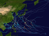
^The position of Bualoi's Category 5 peak is not depicted in this graphic as it is an asynoptic point (i.e. not at the 6-hour intervals of all other points) occurring at 09:00 UTC October 22.
References
^Warning and Summary 181200 (Report). Tokyo, Japan: Japan Meteorological Agency. October 16, 2019. Archived from the original on April 15, 2023. Retrieved April 12, 2023 – via Iowa Environmental Mesonet.
^Warning and Summary 180600 (Report). Tokyo, Japan: Japan Meteorological Agency. October 18, 2019. Archived from the original on April 15, 2023. Retrieved April 12, 2023 – via Iowa Environmental Mesonet.
^Tropical Cyclone Formation Alert (Invest 97W) (Report). Pearl Harbor, Hawaii: Joint Typhoon Warning Center. October 18, 2019. Archived from the original on April 15, 2023. Retrieved April 12, 2023 – via Iowa Environmental Mesonet.
^Tropical Depression 22W (Twenty-two) Warning No. 1 (Report). Pearl Harbor, Hawaii: Joint Typhoon Warning Center. October 19, 2019. Archived from the original on April 15, 2023. Retrieved April 12, 2023 – via Iowa Environmental Mesonet.
^Prognostic Reasoning for Tropical Storm 22W (Bualoi) Warning No. 3 (Report). Pearl Harbor, Hawaii: Joint Typhoon Warning Center. October 19, 2019. Archived from the original on April 15, 2023. Retrieved April 15, 2023 – via Iowa Environmental Mesonet.
^Warning 191200 (Report). Tokyo, Japan: Japan Meteorological Agency. October 19, 2019. Archived from the original on April 15, 2023. Retrieved April 15, 2023 – via Iowa Environmental Mesonet.
^Warning 200000 (Report). Tokyo, Japan: Japan Meteorological Agency. October 20, 2019. Archived from the original on April 15, 2023. Retrieved April 15, 2023 – via Iowa Environmental Mesonet.
^Prognostic Reasoning for Tropical Storm 22W (Bualoi) Warning No. 5 (Report). Pearl Harbor, Hawaii: Joint Typhoon Warning Center. October 20, 2019. Archived from the original on April 15, 2023. Retrieved June 30, 2023 – via Iowa Environmental Mesonet.
^Prognostic Reasoning for Typhoon 22W (Bualoi) Warning No. 6 (Report). Pearl Harbor, Hawaii: Joint Typhoon Warning Center. October 20, 2019. Archived from the original on April 15, 2023. Retrieved June 30, 2023 – via Iowa Environmental Mesonet.
^Prognostic Reasoning for Typhoon 22W (Bualoi) Warning No. 8 (Report). Pearl Harbor, Hawaii. October 20, 2019. Archived from the original on April 15, 2023. Retrieved June 30, 2023 – via Iowa Environmental Mesonet.
^Prognostic Reasoning for Typhoon 22W (Bualoi) Warning No. 12 (Report). Pearl Harbor, Hawaii: Joint Typhoon Warning Center. October 21, 2019. Archived from the original on July 1, 2023. Retrieved June 30, 2023 – via Iowa Environmental Mesonet.
^Prognostic Reasoning for Typhoon 22W (Bualoi) Warning No. 13 (Report). Pearl Harbor, Hawaii: Joint Typhoon Warning Center. October 22, 2019. Archived from the original on July 1, 2023. Retrieved June 30, 2023 – via Iowa Environmental Mesonet.
^"2019 Super Typhoon BUALOI (2019290N08169)". IBTrACS - International Best Track Archive for Climate Stewardship. Asheville, North Carolina: North Carolina Institute for Climate Studies. Archived from the original on April 16, 2023. Retrieved June 30, 2023.
^Prognostic Reasoning for Typhoon 22W (Bualoi) Warning No. 17 (Report). Pearl Harbor, Hawaii: Joint Typhoon Warning Center. October 23, 2019. Archived from the original on July 1, 2023. Retrieved June 30, 2023 – via Iowa Environmental Mesonet.
^Prognostic Reasoning for Typhoon 22W (Bualoi) Warning No. 20 (Report). Pearl Harbor, Hawaii: Joint Typhoon Warning Center. October 23, 2019. Archived from the original on July 1, 2023. Retrieved June 30, 2023 – via Iowa Environmental Mesonet.
^Prognostic Reasoning for Typhoon 22W (Bualoi) Warning No. 21 (Report). Pearl Harbor, Hawaii: Joint Typhoon Warning Center. October 24, 2019. Archived from the original on July 1, 2023. Retrieved June 30, 2023 – via Iowa Environmental Mesonet.
^Prognostic Reasoning for Typhoon 22W (Bualoi) Warning No. 22 (Report). Pearl Harbor, Hawaii: Joint Typhoon Warning Center. October 24, 2019. Archived from the original on July 1, 2023. Retrieved June 30, 2023 – via Iowa Environmental Mesonet.
^Typhoon 22W (Bualoi) Warning No. 26 (Report). Pearl Harbor, Hawaii: Joint Typhoon Warning Center. October 25, 2019. Archived from the original on July 1, 2023. Retrieved June 30, 2023 – via Iowa Environmental Mesonet.
^"WEATHER UPDATE: Tinian, Saipan now under typhoon warning; Guam remains in tropical storm watch". The Guam Daily Post. October 20, 2019. Archived from the original on November 17, 2022. Retrieved March 3, 2021.
^"CNMI in Typhoon Condition 3 in preparation for Tropical Storm Bualoi". Kandit News Group. October 19, 2019. Archived from the original on January 26, 2021. Retrieved March 3, 2021.
^"Guam remains in COR 4, Typhoon Bualoi continues toward Marianas". The Guam Daily Post. October 21, 2019. Archived from the original on November 17, 2022. Retrieved March 3, 2021.
^"Typhoon spurs federal emergency for Northern Mariana Islands". Yahoo! News. Associated Press. October 20, 2019. Archived from the original on November 17, 2022. Retrieved March 3, 2021.
^"Northern Marianas on alert for Typhoon Bualoi". Radio New Zealand. October 21, 2019. Archived from the original on January 26, 2021. Retrieved March 3, 2021.
^"Bualoi Update: Water Supply off at 9pm". Saipan Tribune. October 21, 2019. Archived from the original on September 17, 2021. Retrieved March 3, 2021.
^ECHO (October 21, 2019). "Japan, Northern Mariana Islands - Tropical Cyclone NEOGURI and BUALOI (GDACS, JTWC, JMA, NOAA, media) (Echo Daily Flash of 21 October 2019)". ReliefWeb. Archived from the original on November 15, 2019. Retrieved March 3, 2021.
^"President Donald J. Trump Signs Emergency Declaration for the Commonwealth of the Northern Mariana Islands | FEMA.gov". www.fema.gov. Archived from the original on November 19, 2022. Retrieved November 19, 2022.
^ abc"令和元年台風21号(2019年10月25日) | 災害カレンダー". Yahoo!天気・災害 (in Japanese). Archived from the original on November 19, 2022. Retrieved November 19, 2022.
^"Spate of typhoon deaths during travel in cars underscores need for early evacuations". The Japan Times. October 28, 2019. Archived from the original on November 19, 2022. Retrieved November 19, 2022.
^10月25日からの大雨による被害状況(別紙2) (PDF) (Report) (in Japanese). Fire and Disaster Management Agency. Archived (PDF) from the original on August 5, 2023. Retrieved August 5, 2023.
^Weather, Climate & Catastrophe Insight: 2019 Annual Report (PDF). AON Benfield (Report). AON Benfield. January 22, 2020. Archived from the original (PDF) on January 22, 2020. Retrieved January 19, 2023.
^"25日の千葉・福島の大雨被害 13人死亡" (in Japanese). NHK. October 31, 2019. Archived from the original on October 31, 2019. Retrieved August 5, 2023.
^"相馬・松川浦湾内で不明38歳男性の遺体発見 大雨で車流される" (in Japanese). Minyu-Net. November 1, 2019. Archived from the original on November 1, 2019. Retrieved August 5, 2023.
^"大雨、千葉と福島で死者10人に 1カ月分超の雨量襲う" (in Japanese). October 26, 2019. Archived from the original on April 11, 2023. Retrieved August 5, 2023.
^"浸水想定区域外で被害 避難所や市役所、死者も" (in Japanese). CHUNICHI Web. October 28, 2019. Archived from the original on October 28, 2019. Retrieved August 5, 2023.
^"千葉県内で約2万3400戸が停電(午後5時半時点)" (in Japanese). NHK. October 25, 2019. Archived from the original on October 26, 2019. Retrieved August 5, 2023.
^"25日の大雨 10人死亡 不明の1人の捜索続く" (in Japanese). NHK. October 27, 2019. Archived from the original on October 27, 2019. Retrieved August 5, 2023.
^"記録的豪雨、死者10人不明1人 27河川浸水、土砂災害も" (in Japanese). The Sankei News. October 26, 2019. Archived from the original on October 26, 2019. Retrieved August 5, 2023.
^"児童や生徒1200人余りが帰宅できず 千葉" (in Japanese). NHK. October 26, 2019. Archived from the original on October 26, 2019. Retrieved August 5, 2023.
^"千葉県内中心に運転見合わせや通行止め続く(26日12時半)" (in Japanese). NHK. October 26, 2019. Archived from the original on October 26, 2019. Retrieved August 5, 2023.
^令和元年台風第19号等による被害状況等について(第31報) (PDF) (Report) (in Japanese). Ministry of Land, Infrastructure, Transport and Tourism. Archived (PDF) from the original on August 5, 2023. Retrieved August 5, 2023.
^"JR久留里線 1週間ぶり全線で運転再開 千葉" (in Japanese). NHK. November 1, 2019. Archived from the original on November 1, 2019. Retrieved August 5, 2023.
^"千葉豪雨で浸水「もう住めない」 茂原や佐倉「こんな冠水 初めて」" (in Japanese). TOKYO Web. October 27, 2019. Archived from the original on May 8, 2021. Retrieved August 5, 2023.
^令和元年台風第19号等に係る被害状況等について(令和元年11月8日7:00現在) (PDF) (Report) (in Japanese). Cabinet Office Emergency Disaster Response Headquarters. Archived (PDF) from the original on September 30, 2022. Retrieved August 5, 2023.
External links
Wikimedia Commons has media related to Typhoon Bualoi (2019).


 Extratropical cyclone, remnant low, tropical disturbance, or monsoon depression