Urmeniș
Commune in Bistrița-Năsăud, Romania
(2020–2024) (2021-12-01)[1]
427370
Urmeniș (Hungarian: Mezőörményes) is a commune in Bistrița-Năsăud County, Transylvania, Romania. It is composed of ten villages: Câmp, Coșeriu, Delureni (Mezőújlak), Fânațe (Szarvadi szénafűdűlő), Podenii (Kisújlak), Scoabe, Șopteriu (Septér), Urmeniș, Valea (Fundáta), and Valea Mare (Völgytanya).
Geography
The commune is situated on the Transylvanian Plateau, at an altitude of 390 m (1,280 ft). It is located at the southern extremity of Bistrița-Năsăud County, at a distance of 55 km (34 mi) from the county seat, Bistrița, on the border with Mureș County. Urmeniș is crossed by national road DN16 [ro], which connects Cluj-Napoca, 70 km (43 mi) to the west, to Reghin, 33 km (21 mi) to the east.
Natives
- Alexandru Dobra (1794–1870), Greek Catholic hierarch
References
- ^ "Populaţia rezidentă după grupa de vârstă, pe județe și municipii, orașe, comune, la 1 decembrie 2021" (XLS). National Institute of Statistics.
-
 Rákóczi-Bánffy Castle in Urmeniș
 -
 Orthodox church in Urmeniș
 -
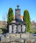 World War Memorial in Urmeniș
 -
 Delureni


- v
- t
- e
Bistrița-Năsăud County, Romania
- Bistrița (county seat)

- Bistrița Bârgăului
- Braniștea
- Budacu de Jos
- Budești
- Căianu Mic
- Cetate
- Chiochiș
- Chiuza
- Ciceu-Giurgești
- Ciceu-Mihăiești
- Coșbuc
- Dumitra
- Dumitrița
- Feldru
- Galații Bistriței
- Ilva Mare
- Ilva Mică
- Josenii Bârgăului
- Lechința
- Leșu
- Livezile
- Lunca Ilvei
- Măgura Ilvei
- Maieru
- Mărișelu
- Matei
- Miceștii de Câmpie
- Milaș
- Monor
- Negrilești
- Nimigea
- Nușeni
- Parva
- Petru Rareș
- Poiana Ilvei
- Prundu Bârgăului
- Rebra
- Rebrișoara
- Rodna
- Romuli
- Runcu Salvei
- Salva
- Sânmihaiu de Câmpie
- Șanț
- Șieu
- Șieu-Odorhei
- Șieu-Măgheruș
- Șieuț
- Silivașu de Câmpie
- Șintereag
- Spermezeu
- Târlișua
- Teaca
- Telciu
- Tiha Bârgăului
- Uriu
- Urmeniș
- Zagra
 | This Bistrița-Năsăud County location article is a stub. You can help Wikipedia by expanding it. |
- v
- t
- e


