Wibsey
Ward in the City of Bradford, West Yorkshire, England
Human settlement in England
Wibsey (population 14,530 – 2001 UK census) is a ward within the City of Bradford Metropolitan District Council, West Yorkshire, England.[2] The population had increased to 14,671 at the 2011 Census.[3] Wibsey is named after Wibsey village which makes up the main part of the ward. As well as the area of Wibsey, the ward includes the area of Bankfoot to the east and much of the area of Odsal. It is located on a ridge which runs from the city centre, up to Queensbury, which has been credited as the highest market town in England.
History

Toponymy
Wibsey means "Wibba's island", from the Old English personal name Wibba (possessive -s) + ēg (island, marsh).[4] Local road-names, such as Harbour Road, support this meaning. An alternative derivation is that wib is a corruption of Old English with, meaning witheys or willows. Wibsey would thus be "willow island".[5] The terrace of houses in Wibsey called Palm Close, where palm refers to willows rather than the more exotic palm tree would seem to support this theory. Yet another theory has Wibsey as "land or hill of Wigbeort [personal name]".[5]
Early history
Under the Danelaw Wibsey was in the wapentake of Morley. It became an independent manor under the Normans when it was granted to the de Lacy family. The whole area had been laid waste during the Harrying of the North and it was up to fifty years before it recovered.[5]
Eventually the manor passed to the Danby family of Farnley, Leeds and was then purchased by the Rookes family of Royds Hall, near Huddersfield and subsumed into a wider estate that also included North Bierley.[6]
By the 19th century, the main development in Wibsey was centred on Holroyd Hill. Elsewhere, small farm cottages (some of which survive today) were the main residences. They formed a ring around Wibsey Slack, an area of marshland, coal mines and slag heaps, whose existence is remembered today in local place names like Slackside and Slack Bottom Road. In fact, Wibsey remained an isolated, rural community until very late in its existence. It was not incorporated into Bradford until 1899.[7] As a result, the medieval system of strip farming was a feature of Wibsey's landscape until well into the 19th century, much longer than elsewhere in England. Wibsey's antiquity is still visible today, with certain houses dating back to the early 17th century.[8]
20th century
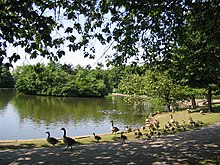
An Enclosure Act of 1881 laid the way for the development of modern Wibsey. Wibsey Park, North Bierley Cemetery and Harold Park are all direct results of this Act. Further development occurred in the 1920s and 1930s. Odsal council estate dates from this period, as does the area around St. Paul's Avenue.
Governance
- Councillors
Wibsey ward is represented on Bradford Council by three Labour councillors, Joanne Sharp, Ralph Berry and David Green.[9]
| Election | Councillor | Councillor | Councillor | |||
|---|---|---|---|---|---|---|
| 2004 | Arthur Collins Redfearn (BNP) | Ralph David Ritchie Berry (Lab) | David Michael Adam Green (Lab) | |||
| 2006 | Lynne Eleanor Smith (Lab) | Ralph Berry (Lab) | David Green (Lab) | |||
| 2007 | Lynne Smith (Lab) | Ralph Berry (Lab) | David Green (Lab) | |||
| 2008 | Lynne Smith (Lab) | Ralph Berry (Lab) | David Green (Lab) | |||
| 2010 | Lynne Smith (Lab) | Ralph Berry (Lab) | David Green (Lab) | |||
| 2011 | Lynne Smith (Lab) | Ralph Berry (Lab) | David Green (Lab) | |||
| 2012 | Lynne Smith (Lab) | Ralph Berry (Lab) | David Green (Lab) | |||
| 2014 | Lynne Smith (Lab) | Ralph Berry (Lab) | David Green (Lab) | |||
| 2015 | Lynne Smith (Lab) | Ralph Berry (Lab) | David Green (Lab) | |||
| 2016 | Lynne Smith (Lab) | Ralph Berry (Lab) | David Green (Lab) | |||
| By-election 14 July 2017 | Joanne Lisa Sharp (Lab)[10][11] | Ralph Berry (Lab) | David Green (Lab) | |||
indicates seat up for re-election. indicates a by-election.
Wibsey Fair
Wibsey was an important market village and hosts its own horse fair every year on 5 October. Fair Road has a funfair site, which has been established for many generations.
The origins of Wibsey Fair are uncertain. Some believe the monks of Kirkstall Abbey began the fair in the 12th or 13th century to provide an income, although the first documentary evidence comes with a reference in a dispute between former Lords, William Rookes and John de Lacy, to the "Revey Cross, sett up and standing at Revey Nabbe" where a fair was held.[12] This would place the fairground near modern-day Buttershaw estate, where roads entitled "Reevy" exist today. By the mid 19th century the fairground was at or near its present site, hence the local road name Fair Road.[12]
Wibsey is also notable for the number of pubs in a small village. The Wibsey Working Men's Club (founded 1905) featured on the BBC's White series, in a film examining the decline of the working men's club, and British working class society in general.[13]
Notable residents
- Samuel Bottomley, actor[14]
- Jean-Jacques Burnel, bass player with The Stranglers, lived in Wibsey whilst studying at Bradford University[15]
- Susan Fassbender, musician
- Chris Fountain, actor [16]
- Mason Greenwood, footballer for Getafe CF
- Yvonne McGregor, cyclist
- John Orwin, former England Rugby Union captain
- Frank Whitcombe, former Bradford Bulls and Great Britain rugby player
See also
- Listed buildings in Bradford (Wibsey Ward)
References
- ^ "BBC election results". BBC. Retrieved 17 April 2013.
- ^ "Council and Democracy: Wibsey". Bradford City Council. Retrieved 17 April 2013.
- ^ "City of Bradford ward population 2011". Neighbourhood Statistics. Office for National Statistics. Retrieved 22 February 2016.
- ^ Goodall 1913, pp. 134–5, 299.
- ^ a b c Carpenter 1992, p. 1.
- ^ Carpenter 1992, pp. 3–4.
- ^ Carpenter 1992, pp. 5.
- ^ Wibsey Miscellany No. 5 2010, p. 9.
- ^ "Your councillors by ward". bradford.moderngov.co.uk. City of Bradford Metropolitan District Council. Retrieved 27 September 2017.
- ^ Wilde, Claire (15 May 2016). "Tributes paid to senior Bradford councillor who died today". Telegraph and Argus. Retrieved 27 September 2017.
- ^ Wilde, Claire (15 July 2016). "Labour holds Wibsey seat in council by-election". Telegraph and Argus. Retrieved 27 September 2017.
- ^ a b Carpenter 1992, p. 39.
- ^ Wibsey Miscellany No. 5 2010, p. 15.
- ^ "Sam stars in major new Yorkshire drama". Telegraph & Argus. Retrieved 26 November 2019.
- ^ "Music: Stranglers put the boot in!". Bradford Telegraph and Argus.
- ^ Clayton, Emma (10 March 2017). ""It's essentially a man's story": Chris Fountain stars in The Full Monty". Telegraph & Argus. Retrieved 23 November 2022.
Bibliography
- Carpenter, Stella H. (1992). The Manor of Wibsey: The Town & District. Bradford: Bradford Libraries. ISBN 9780907734284.
- Goodall, Armitage (1913). Place-names of South-west Yorkshire. Cambridge University Press. pp. 134–5, 299. Retrieved 16 December 2016.
- Wibsey Miscellany No.5. Bradford: Wibsey Local History Group. 2010.
External links
Wikimedia Commons has media related to Wibsey.
- "Bradford Community Statistics Project". Bradford City Council. Retrieved 17 April 2013.(Internet Explorer only)
- Wibsey at Curlie.
- v
- t
- e
villages,
areas
and wards
- Addingham
- Allerton
- Apperley Bridge
- Baildon
- Barkerend
- Belle Vue
- Ben Rhydding
- Bingley
- Bingley Rural
- Bingley ward
- Bolton and Undercliffe
- Bowling and Barkerend
- Bradford
- Bradford Moor
- Broomfields
- Burley in Wharfedale
- Burley Woodhead
- Buttershaw
- City of Bradford
- City ward
- Clayton
- Cottingley
- Craven ward
- Crossflatts
- Cross Roads
- Cullingworth
- Cutler Heights
- Denholme
- Dudley Hill
- East Morton
- East Bowling
- Eastburn
- Eccleshill
- Egypt
- Eldwick
- Esholt
- Frizinghall
- Forster Square
- Gilstead
- Girlington
- Great Horton
- Greengates
- Hainworth
- Harden
- Haworth
- Haworth, Cross Roads and Stanbury
- Heaton
- Holme Wood
- Idle
- Idle and Thackley
- Ilkley
- Ingrow
- Keighley
- Keighley Central
- Keighley East
- Keighley West
- Laisterdyke
- Laycock
- Little Germany
- Little Horton
- Long Lee
- Longlands
- Low Moor
- Lumbfoot
- Manningham
- Menston
- Oakenshaw
- Oakworth
- Odsal
- Oldfield
- Oxenhope
- Queensbury
- Ravenscliffe
- Riddlesden
- Royds
- Ryecroft
- Saltaire
- Sandy Lane
- Shipley
- Silsden
- Staithgate
- Stanbury
- Steeton
- Steeton with Eastburn
- Thackley
- Thornbury
- Thornton
- Thornton and Allerton
- Thorpe Edge
- Toller
- Tong ward
- Tong village
- Trident
- Tyersal
- Wharfedale ward
- Wibsey
- Wilsden
- Windhill and Wrose
- Worth Valley
- Wrose
- Wyke
- Bradford-Keighley Youth Parliament
- City of Bradford Metropolitan District Council
- Constituencies
- Council
- Councillors
- Parishes
- Politics
- Wards
Leisure and
Tourism
| Education | |
|---|---|
| Health |
| Publishing | |
|---|---|
| Radio |
|
| TV |
| Clubs |
|
|---|---|
| Venues |
|
| Rivers | |
|---|---|
| Canals | |
| Crossings |
| Air | |
|---|---|
| Rail |
|
| Bus | |
| Road |
- Crime
- History
- Military
- Postcodes
- Timeline
- People
- Geology
- Aire Valley Fault
- Denholme Clough Fault
 Category
53°46′2″N 1°46′22″W / 53.76722°N 1.77278°W / 53.76722; -1.77278


