Duiven
Municipality in Gelderland, Netherlands

Flag

Coat of arms

Location in Gelderland
(January 2021)[4]
6920–6924
Duiven (Dutch pronunciation: [ˈdœyvə(n)] ⓘ) is a municipality and a town in the eastern Netherlands. Duiven's name can be translated into English to mean "pigeons" or "doves". Although the coat of arms and logo of the municipality feature pigeons, the name is etymologically related to "dunes" (Dutch: duinen). The flag of the municipality of Duiven was granted and adopted on 25 June 1954.
Population centres
Villages:
- Duiven
- Groessen
- Loo
Hamlets:
- De Eng
- Helhoek
- Nieuwgraaf
Topography
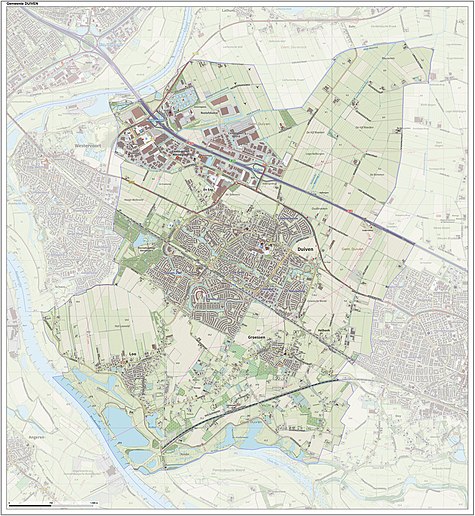
Dutch Topographic map of the municipality of Duiven, June 2015
Transportation
- Duiven railway station is served by trains from Arnhem to Doetinchem and Winterswijk.
On weekdays there are 4 trains per hour between Arnhem and Doetinchem, with two of these continuing to Winterswijk. On weekends there are 2 trains per hour between Arnhem and Winterswijk.
Notable people
- Dean Koolhof (born 1994) a Dutch professional footballer, with over 100 club caps, plays for Helmond Sport
Twin towns
Duiven is twinned with:


Gallery
-
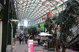 Duiven Plaza Intratuin
 -
 Duiven, view of De Passage shopping centre, from the bridge next to IKC Remigius
 -
 Loowaerd, Loo
 -
 Rubbish incineration plant at Westervoort


References
- ^ "College van B&W" [Board of mayor and aldermen] (in Dutch). Gemeente Duiven. Archived from the original on 27 June 2014. Retrieved 24 June 2014.
- ^ "Kerncijfers wijken en buurten 2020" [Key figures for neighbourhoods 2020]. StatLine (in Dutch). CBS. 24 July 2020. Retrieved 19 September 2020.
- ^ "Postcodetool for 6921ES". Actueel Hoogtebestand Nederland (in Dutch). Het Waterschapshuis. Retrieved 24 June 2014.
- ^ "Bevolkingsontwikkeling; regio per maand" [Population growth; regions per month]. CBS Statline (in Dutch). CBS. 1 January 2021. Retrieved 2 January 2022.
External links
 Media related to Duiven at Wikimedia Commons
- Official website
Places adjacent to Duiven | |
|---|---|


- v
- t
- e
- Aalten
- Apeldoorn
- Arnhem
- Barneveld
- Berg en Dal
- Berkelland
- Beuningen
- Bronckhorst
- Brummen
- Buren
- Culemborg
- Doesburg
- Doetinchem
- Druten
- Duiven
- Ede
- Elburg
- Epe
- Ermelo
- Harderwijk
- Hattem
- Heerde
- Heumen
- Lingewaard
- Lochem
- Maasdriel
- Montferland
- Neder-Betuwe
- Nijkerk
- Nijmegen
- Nunspeet
- Oldebroek
- Oost Gelre
- Oude IJsselstreek
- Overbetuwe
- Putten
- Renkum
- Rheden
- Rozendaal
- Scherpenzeel
- Tiel
- Voorst
- Wageningen
- West Betuwe
- West Maas en Waal
- Westervoort
- Wijchen
- Winterswijk
- Zaltbommel
- Zevenaar
- Zutphen

- See also
- Netherlands
- Provinces
- Municipalities
| Authority control databases: Geographic |
|
|---|
 | This Gelderland location article is a stub. You can help Wikipedia by expanding it. |
- v
- t
- e


