Masaka–Mbarara Road
Road in Uganda
| Masaka–Mbarara Road | |
|---|---|
| Route information | |
| Length | 95.8 mi (154.2 km) |
| History | Designated in 2008 Completion in 2011 |
| Major junctions | |
| East end | Masaka |
| Major intersections | Lyantonde |
| North end | Mbarara |
| Location | |
| Country | Uganda |
| Highway system | |
The Masaka–Mbarara Road is a road in the Central and Western Regions of Uganda, connecting the cities of Masaka in Masaka District, Central Region and Mbarara in Mbarara District, Western Region.[1]
Location
The road starts at Masaka and goes through Lyantonde, and ends in Mbarara, a distance of about 138 kilometres (86 mi).[2] The road improvements involved road extensions making the contract road length 154.2 kilometres (96 mi).[3] The coordinates of the road west of the town of Lyantonde are 0°26'00.0"S, 31°05'40.0"E (Latitude:-0.433343; Longitude:31.094438).[4]
Overview
Before 2008, the road had a bitumen surface in poor state. In 2008, the government of Uganda, with funding from the European Union, began upgrading the road to grade II bitumen surface with shoulders, culverts, and drainage channels. The work was contracted to Reynolds Construction Company of Nigeria,[5] at a cost of Sh230 billion (approx. €79 or US$104 million at that time).[1][6]
See also
References
- ^ a b Robert Barnes (27 August 2014). "Construction Of The Masaka – Mbarara Road". Nairobi: Construction Review Online. Retrieved 8 July 2018.
- ^ Globefeed.com (13 February 2016). "Distance between Masaka, Central Region, Uganda and Mbarara, Western Region, Uganda". Globefeed.com. Retrieved 13 February 2016.
- ^ UNRA (13 February 2016). "Masaka-Mbarara Road (154.2km)". Kampala: Uganda National Roads Authority (UNRA). Retrieved 13 February 2016.
- ^ Google (13 February 2014). "Location of Masaka–Mbarara Road" (Map). Google Maps. Google. Retrieved 13 February 2014.
- ^ Bindhe (14 May 2011). "Road Construction Workers Block Mbarara -Masaka Highway". Kampala: Uganda Radio Network. Retrieved 13 February 2016.
- ^ Mambule, Ali (4 July 2008). "Masaka-Mbarara road repair starts". New Vision. Kampala. Retrieved 13 February 2016.
External links
- Website of Uganda National Roads Authority
00°26′00″S 31°05′40″E / 0.43333°S 31.09444°E / -0.43333; 31.09444
- v
- t
- e

Capital: Masaka
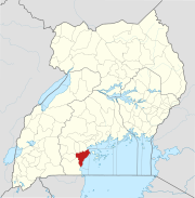
- Lake Victoria
- Lake Nabugabo
- River Nabajuzi
| ||
|---|---|---|
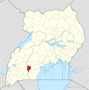
Capital: Lwengo | ||
| Towns and villages |  | |
| Economy |
| |
| Transport |
| |
| Health |
| |
| ||
|---|---|---|
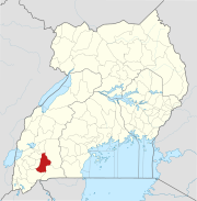
Capital: Lyantonde | ||
| Counties and sub-counties |
|  |
| Towns and villages |
| |
| Banking | ||
| Notable landmarks | ||
| Notable people |
| |
| ||
|---|---|---|
Capital: Kiruhura | ||
| Counties and sub-counties |
|  |
| Towns and villages | ||
| Economy | ||
| Transport |
| |
| Health | ||
| Notable landmarks | ||
| Notable people |
| |
| ||
|---|---|---|
Capital: Mbarara | ||
| Counties and sub-counties |
|  |
| Towns and villages |
| |
| Economy |
| |
| Notable landmarks | ||
| Transport | ||
| Health | ||
| Education | ||
| Notable people | ||


