Mbarara–Ishaka Road
Major junctions
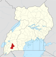
Bushenyi
Mbarara–Ishaka Road is a road in the Western Region of Uganda, connecting the towns of Mbarara in Mbarara District with Ishaka in Bushenyi District.
Location
The road starts in Mbarara, the largest city in Western Uganda, extending westwards through Kabwohe and Bushenyi to end at Ishaka, a distance of about 61 kilometres (38 mi).[1] The coordinates of the road near Kabwohe are 0°34'46.0"S, 30°23'31.0"E (Latitude:-0.579453; Longitude:30.391942).[2]
Overview
This road is a major transport corridor in the sub-region and for traffic from the sub-region to the urban centers of Mbarara and further east, Masaka and Kampala. The road was last renovated between September 1987 and December 1994, with loans from the World Bank.[3]
See also
References
- ^ GFC (22 May 2016). "Distance between Golf Course Road, Mbarara, Western Region, Uganda and Caltex petrol station, Ntungamo-Katunguru Road, Ishaka, Western Region, Uganda". Globefeed.com (GFC). Retrieved 22 May 2016.
- ^ Google (22 May 2016). "Location of Mbarara–Ishaka Road" (Map). Google Maps. Google. Retrieved 22 May 2016.
- ^ WB (1 June 1995). "Report No. 14554: Implementation Completion Report: Uganda Fourth Highway Project (CREDIT 1803-UG)". Washington, DC: World Bank (WB). Retrieved 22 May 2016.
External links
- Uganda National Road Authority Homepage
- 4). Project Completion Report - Rehabilitation the Ishaka-Katunguru Road, Uganda
- v
- t
- e

Capital: Bushenyi
sub-counties
- Igara County

- Igara County East
- Igara County West
- Ishaka–Kagamba Road
- Kikorongo–Ishaka Road
- Mbarara–Ishaka Road
- Kashenyi–Mitooma Road
| ||
|---|---|---|
Capital: Kibingo | ||
| Counties and sub-counties | Sheema County |  |
| Towns and villages | ||
| Transport |
| |
| Notable landmarks | ||
| Education | ||
| Health | ||
| Notable people | ||
| ||
|---|---|---|
Capital: Mbarara | ||
| Counties and sub-counties |
|  |
| Towns and villages |
| |
| Economy |
| |
| Notable landmarks | ||
| Transport | ||
| Health | ||
| Education | ||
| Notable people | ||
00°34′46″S 30°23′31″E / 0.57944°S 30.39194°E / -0.57944; 30.39194


